


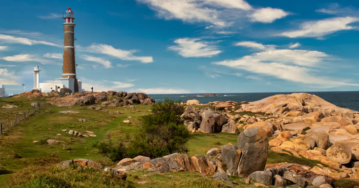
The geography of Uruguay is a portrait of a small nation in south-eastern South America, nestled between Argentina and Brazil on the Atlantic coast. It is a land of gentle plains, rolling cuchillas hills, and vast pampa grasslands, with a mild and pleasant climate year-round.
Contents
Location and general characteristics of Uruguay’s geography
When speaking about Geography of Uruguay, the first thing to remember is its modest scale. It is one of the smallest countries in South America, larger only than Suriname in the region. The entire territory lies in the south-east of the continent, along the Atlantic Ocean, creating a compact and easily visualised strip of land on the map.
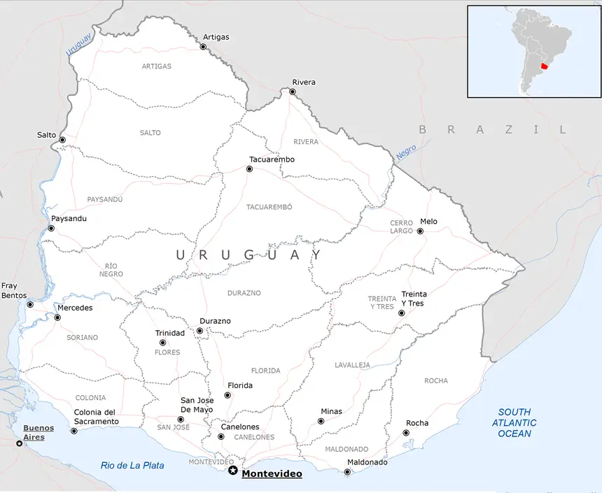
This country has a strategic position as a buffer zone between two large nations. To the west, it borders Argentina via the Uruguay River and the wide Río de la Plata estuary, while to the north and north-east, it borders Brazil. That position makes the region the country of Uruguay a natural transit point between the two largest economies in the region.
A striking feature is the relative uniformity of the terrain. Unlike many South American countries with high mountain ranges or the Amazon rainforest, the territory here has almost no high mountains. The entirety is a blend of low plains and gently rolling hills, creating favourable conditions for agriculture and livestock farming.
The capital, Montevideo, is located right on the banks of the Río de la Plata, in the south of the country. It is both an administrative centre and an important seaport, and it is where the majority of the population is concentrated. The waterfront location of Montevideo reflects a general characteristic: most economic activity and the population are oriented towards the south, where it meets the sea and the estuary.
Considering a residency programme? The Prosperous Living Investment team assesses your profile free of charge and advises on the pathway that fits your goals.
Plains and rolling cuchillas hills
The most characteristic terrain of this nation is the alternation between wide plains and low, rolling hill ranges. Locals call these hill ranges cuchillas, a term describing elongated ridges with rounded tops and gentle slopes. They are not as high or rugged as mountains, but rather undulate gently like fixed waves on the ground.
The cuchillas act as natural watersheds, separating river basins. Two main systems often mentioned are Cuchilla Grande and Cuchilla de Haedo, which run in a north-easterly direction and form the skeleton of the terrain. Although called hills, their height is generally modest and they do not create significant transport barriers.
The highest point in the country also belongs to the hill category, not true mountains by international standards. Cerro Catedral is often considered the highest peak, yet its height remains very modest. Therefore, the entire territory can be described as a low, eroded plateau, where there are no rugged plateaus or deep valleys.
This gentle undulation provides practical advantages. The land is easy to cultivate, easy to graze, and convenient for building transport infrastructure. Furthermore, the landscape of rolling green hills also contributes to shaping the typical image of a peaceful pastoral land.
Pampa grasslands and grazing land
Most of the country’s area is covered by natural grasslands, belonging to the vast pampa ecosystem that stretches across both Argentina and southern Brazil. These are temperate prairies with thick grass and few large trees, which are very suitable for year-round livestock grazing without the need for complex barns.
The pampa grasslands are the natural foundation for the cattle and sheep farming industry, which is closely linked to Uruguayan economy. The number of livestock is actually said to be higher than the human population, reflecting the central role of livestock farming in daily life and exports. Naturally grazed beef from the grasslands is a product associated with the nation’s reputation.
The grassland ecosystem also contributes to shaping rural culture. The image of the gaucho cowboy riding a horse across the vast prairie is a familiar symbol, associated with the traditions and identity of the interior region. The wide carpet of grass also maintains soil fertility and supports the biodiversity characteristic of the temperate zone.
Although it is mostly grassland, there are still areas of natural forest along the rivers and in low-lying areas. These are narrow riparian forest strips that play an important role in water retention and bank protection. In addition, plantations serving the timber and paper industries have also expanded in recent decades, partially changing the traditional landscape.
Uruguay River, Río Negro, and the hydrological network
The dense river network is an inseparable part of the terrain. The most important river on the western border is the Uruguay River, which also gives the country its name. This river forms a natural boundary with Argentina before flowing into the Río de la Plata estuary in the south.
Within the territory, the largest river is the Río Negro, which flows from the north-east to the south-west and divides the country into two quite distinct halves, north and south. The Río Negro is a tributary of the Uruguay River and plays a central role in water supply as well as power generation. On this river, there is a large artificial reservoir serving hydroelectric power, an important energy source.
The Río de la Plata estuary in the south is a prominent geographical feature. This is a vast estuarine region where the Uruguay River and the Paraná River merge before meeting the Atlantic Ocean. This wide brackish water area is both a shipping route and a soft boundary between the two nations, while also shaping the climate and life of the capital region.
Overall, most of the rivers belong to the Río de la Plata basin and eventually flow into the Atlantic Ocean. The abundance of surface water gives the country an advantage in hydroelectric power, irrigation, and water transport. In addition, lagoons and wetlands along the eastern coast also add to the diverse hydrological picture.
Atlantic coast and Punta del Este
The coastline is one of the most valuable geographical assets of the nation. The strip of coast runs from the Río de la Plata estuary in the south-west, circles the capital, and then opens up to the Atlantic Ocean in the east. The transition from estuarine water to salty seawater happens gradually, creating many different types of beaches.
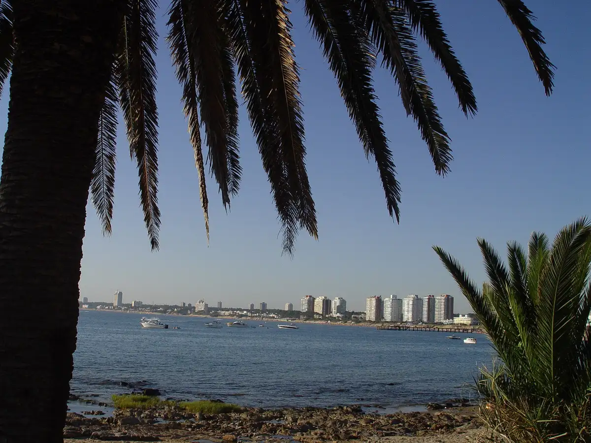
Punta del Este is the most famous coastal destination, located where the estuary meets the ocean. It is considered the leading high-end resort in the region, attracting domestic and international tourists, especially during the Southern Hemisphere summer. Beaches, marinas, and modern structures make this place a tourism icon.
Along the eastern coast, there are also many quieter resort towns, sand dunes, lagoons, and nature reserves. These areas retain their pristine beauty and are home to many species of birds, seals, and marine life. The diversity between vibrant beaches and quiet natural areas enriches the coastal experience.
The location along the Atlantic Ocean also directly affects population distribution and Uruguay demographics. The majority of the population is concentrated in the southern strip, along the river and the coast, where the climate is pleasant and infrastructure is developed. The northern interior is more sparsely populated, consisting mainly of vast agricultural and grazing land.
Mild climate year-round
The climate is one of the most pleasant factors of this land. Located in the temperate zone of the Southern Hemisphere, the entire country has a mild climate that is neither too hot nor too cold. There are four distinct seasons, but the temperature range between seasons is not extreme, and there are rarely prolonged extreme weather events.
Due to its small and flat territory, the climate is relatively uniform across the country, without the significant regional variations found in larger nations. Summer, from approximately December to February, is warm, while winter, from June to August, is cool and humid. Snow is almost non-existent, and light frost occurs only occasionally in the interior.
Rainfall is distributed relatively evenly throughout the year, with no distinct dry season. This is highly favourable for pastures and agriculture, keeping vegetation green for most of the year. However, rainfall can fluctuate between years, occasionally causing droughts or localised flooding that affects production.
Wind is also a notable feature due to the open terrain and coastal location. The pampero wind blowing from the south can bring cool air and, at times, thunderstorms. Overall, the combination of a mild climate, consistent rainfall, and few major natural disasters creates stable living and farming conditions for residents.
Land, water, and natural resources
The most prominent natural resources are fertile land and abundant water sources. The topsoil on the grasslands and plains is suitable for both cultivation and livestock, forming the foundation for the export-oriented agricultural sector. According to national statistical agencies such as National Institute of Statistics of Uruguay, the majority of land area is used for agricultural and livestock purposes.
Abundant surface water from the river and reservoir system provides a dual advantage. On one hand, it serves irrigation and domestic needs; on the other, it is the basis for hydroelectric power, which contributes significantly to the energy mix. Alongside hydropower, the open and windy terrain also creates conditions for developing wind power, a notable renewable energy trend.
Precious metal minerals are not a strength, although the country possesses some resources such as semi-precious stones, granite, and construction materials. According to assessments by World Bank, the national economy relies more on agriculture and services than on mining. This accurately reflects the geological characteristics of the plains and low hills.
Ecologically, the eastern coastal wetlands and riverside forests are biodiversity hotspots. Many areas are protected to preserve habitats for migratory birds and native species. Balancing agricultural exploitation with nature conservation is a long-term challenge for territorial management.
Geographical zoning and territorial organisation
Administratively, the territory is divided into provinces, each with its own geographical characteristics. The province containing the capital, Montevideo, is small in area but the most populous, while the vast interior provinces are sparsely populated and primarily agricultural. This contrast clearly illustrates the pattern of population concentration in the south.
The country can be divided into several large geographical regions for easier visualisation. The region along the Río de la Plata and the Atlantic coast in the south is where urbanisation and tourism are developed. The central interior region with its cuchillas and grasslands is the centre for livestock, while the northern region near Brazil features agricultural characteristics and a slightly warmer climate.
The river system also contributes to shaping the natural regions. The Río Negro divides the country into northern and southern halves, each with slightly different landscape nuances and land use. Major towns, second only to the capital, are typically located along the Uruguay River in the west, where cross-border trade with Argentina is vibrant.
In summary, the organisation of the territory faithfully reflects natural factors: the population clings to the water’s edge, agriculture spreads across the interior grasslands, and borders are defined by rivers and estuaries. This is a country where geography and human life are closely intertwined, creating a harmonious and easily recognisable picture.
Accompanying you on your journey in residency investment
The Prosperous Living Investment team advises on pathways, assesses profiles and manages investments transparently for every residency, citizenship and international property objective.
Free profile assessmentWhere life gets prosperous