

Geography of Switzerland

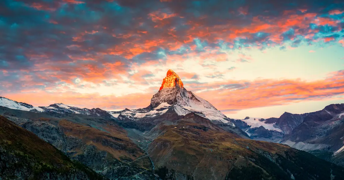
When speaking of Swiss geography, one immediately thinks of a landlocked nation in the heart of Central Europe, with no access to the sea, surrounded by five neighbours and distinguished by the majestic Alps, glaciers, crystal-clear lakes, and many major rivers originating from the high mountains.
Contents
Location and geographical characteristics of Switzerland in the heart of Central Europe
The geography of Switzerland is primarily shaped by its location deep within the European continent, in the Central European region. It is a landlocked nation, meaning it does not border any sea or ocean on any side. The entire territory is surrounded by the land of neighbouring countries, meaning all water-based trade routes must pass through river systems and surrounding nations.
Although not large in terms of area, this country has one of the most diverse terrains in Europe. The transition from high mountains to plateaus and then to low hill ranges occurs over a relatively narrow space. It is this compression of terrain that creates a rich landscape, where visitors can travel from warm valleys to icy, snowy regions in just a few hours.
Its central location also makes it a crossroads for many major cultures and languages. To understand more about the general context of Switzerland, it can be seen that the terrain and location have contributed to the formation of its characteristic federal structure and distinct regional diversity.
According to the federal statistical agency, the majority of the country’s area is mountainous terrain, while flat land suitable for settlement and cultivation accounts for only a modest proportion. This explains why the population and economic activities are heavily concentrated in the central plain strip.
Considering a residency programme? The Prosperous Living Investment team assesses your profile free of charge and advises on the pathway that fits your goals.
Landlocked nation bordering five neighbours
One of the most prominent features of this country is its location bordering five nations. To the north is Germany, to the west is France, to the south is Italy, and to the east it borders Austria and the tiny principality of Liechtenstein. Bordering many countries at once makes it a natural crossroads of Europe.
The border with each country carries its own topographical characteristics. The southern border with Italy mainly runs along the high peaks and ridges of the Alps, while the northwestern boundary with France is linked to the lower Jura range. To the north, the Rhine river acts as a natural border on many sections bordering Germany.
The border with Liechtenstein is an interesting detail, as it is one of the few countries in the world where both sides are landlocked nations. This close geographical relationship is also reflected in many economic and monetary ties between the two sides.
The landlocked nature and bordering many countries have a profound influence on transport and trade. The system of trans-mountain tunnels and modern railway lines helps connect major European transport axes passing through the territory, turning terrain that might seem like an obstacle into a transit advantage.
According to Swiss Federal Statistical Office (BFS), the majority of the population and economic activity is concentrated on the Central Plateau (Mittelland), where major urban areas are located, while the Alps region is more sparsely populated despite occupying a significant area. This distribution reflects the direct influence of terrain on life.
Three major topographical regions: Alps, Mittelland, and Jura
Geographers often divide the territory into three main natural regions, each with very distinct characteristics. These are the Alps in the south and centre, the Central Plateau (Mittelland) in the middle, and the Jura range in the northwest. These three regions form the backbone of the entire landscape.
The Alps occupy the majority of the southern area and are the highest, most rugged region. This is where snow-capped peaks, glaciers, and deep valleys are concentrated. Population density in the high mountains is usually low, but this is an area of great value for tourism, hydroelectricity, and water resources.
The Central Plateau (Mittelland) is a relatively flat and rolling strip of land located between the Alps and the Jura. Although it occupies only a portion of the area, it is the most populous region, concentrating major cities, fertile agricultural land, and most of the infrastructure. Many key economic centres of the Swiss economy are located on this strip of land.
The Jura range in the northwest is a folded limestone mountain system, much lower than the Alps and stretching along the border with France. This region is famous for its forests, pastures, and watchmaking tradition. Such a three-layered terrain explains the uneven population distribution seen in Swiss demographics.
- The Alps: high mountain region in the south, many glaciers and snow-capped peaks, sparsely populated.
- Mittelland: flat central plateau, populous, concentrating urban areas and agriculture.
- Jura range: folded limestone mountains in the northwest, many forests and pastures, bordering France.
High mountain peaks: Dufourspitze and Matterhorn
The Alps provide this country with a series of peaks that are among the highest and most famous in Europe. The highest point in the territory is the Dufourspitze peak, part of the Monte Rosa massif located near the border with Italy. This peak rises to an altitude of over four thousand metres and is an attractive goal for experienced mountaineers.
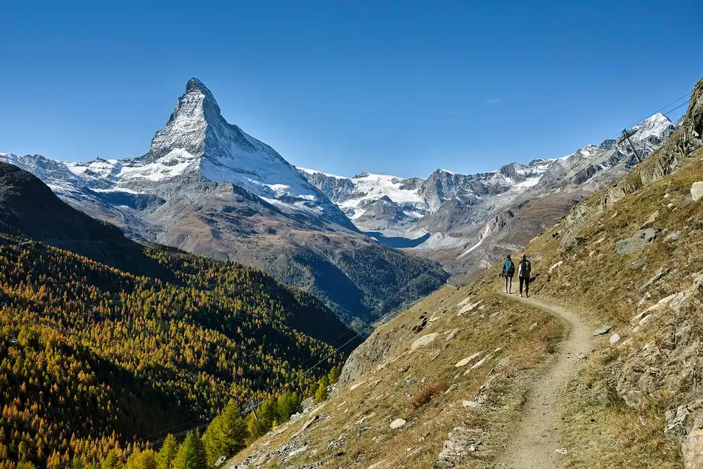
Perhaps the most famous in terms of symbolism is the Matterhorn, a mountain with a nearly symmetrical pyramid shape located in the southern border area with Italy. The characteristic shape of the Matterhorn has become a widely recognized symbol, associated with the mountainous image of the Alps.
Besides these two peaks, the mountain region has many summits exceeding four thousand metres in altitude, forming strips of year-round ice and snow. The high peaks are concentrated mainly in the south and southeast, where the terrain is most rugged.
The high mountains are not just destinations for mountaineering and skiing. They also act as natural water towers, storing snow and ice to provide flow for rivers throughout the summer, a key element in Swiss geography.
Glaciers and the water tower role of the Alps region
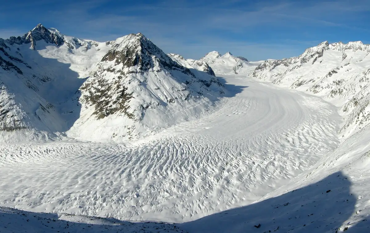
Glaciers are an inseparable feature of the high-altitude landscape. On mountain slopes and valleys at high altitudes, ice masses form through thousands of years of snow accumulation. Among them, the Aletsch glacier in the Alps region is one of the largest and longest glaciers on the European continent.
Glaciers moved slowly, eroding bedrock to carve characteristic U-shaped valleys and numerous glacial lakes. This prolonged geological process helped shape the alpine landscape seen today.
The high mountain regions are often likened to the water towers of Europe because the snow and ice stored here feed many major rivers flowing across the continent. When snow melts during the warmer seasons, water is gradually released, helping maintain a stable downstream flow.
In recent decades, numerous observations show that glaciers tend to shrink. This is a subject closely monitored by the scientific community because it affects water supplies, hydroelectric power, and landscapes. The specific scale and rate of change are professional matters that rely on up-to-date data.
Major lake system: Lake Geneva and Lake Zurich
Lakes are part of what gives the landscape its distinctive beauty. Many lakes were formed by ancient glacier activity, scattered across plateaus and the edges of mountain regions. These lakes serve as water sources, tourist hubs, and vital areas for daily life.
Lake Geneva, located in the southwest and partly shared with France, is one of the largest freshwater lakes in Western Europe. The lake features a characteristic crescent shape, surrounded by famous cities and wine-growing regions. The Rhône River flows through this lake on its journey.
Lake Zurich lies in the northeast, stretching from the city of Zurich to the southeast. This is a long, narrow lake that plays an important role in urban life and water transport in the country’s most densely populated region.
Besides these two prominent lakes, the territory also has many other large lakes such as Lake Constance in the northeast bordering Germany and Austria, or Lake Lugano and Maggiore in the south bordering Italy. The abundant lake system helps regulate water flow and moderates the climate of neighboring regions.
The Rhine and Rhône rivers originating from the mountains
The high mountain region is the origin of some of Europe’s most important rivers. Two representative rivers are the Rhine and the Rhône, both originating from ice masses and high valleys in the Alps region before flowing in very different directions.
The Rhine River originates from the eastern mountain region, flowing north and northwest, becoming a natural border over many stretches, and continuing its long journey through Germany and the Netherlands to empty into the North Sea. This is one of the continent’s most important waterways.
The Rhône River originates from a glacier in the south, flowing west through a wide valley, emptying into Lake Geneva, and then continuing into French territory to finally reach the Mediterranean Sea. Thus, from a relatively small mountain region, water can flow into two completely different seas.
This division of flow makes this place an important watershed of Europe. Water from different mountain slopes can end up in the North Sea, the Mediterranean Sea, the Black Sea, or the Adriatic Sea, depending on the slope direction of the terrain.
Climate varies by altitude and region
The climate here has temperate characteristics, yet it varies greatly with altitude and region. On the central plateau, the weather is relatively mild with four distinct seasons, featuring warm summers and cold, snowy winters. The higher one goes, the lower the temperature drops and the thicker the snow cover becomes.
In the high mountain regions, the climate is much harsher with long winters, prolonged snow cover, and many areas featuring year-round ice and snow. Conversely, some southern valleys bordering Italy have a milder climate with a Mediterranean nuance, allowing the cultivation of warmth-loving plants.
A characteristic weather phenomenon of the mountain region is the foehn wind, a warm and dry wind blowing down mountain slopes, which can cause temperatures to rise rapidly and snow to melt early. This phenomenon affects life and agriculture in many valleys.
Climate diversity according to altitude creates different vegetation zones, ranging from broad-leaved forests in lower areas to coniferous forests, then to alpine meadows, and finally to ice and snow regions. This characteristic clearly reflects the close relationship between terrain and climate in Swiss geography.
Water resources and hydroelectricity
Water is this country’s most abundant and strategically significant natural resource. Significant rainfall alongside huge reserves of snow and ice on the high mountains create a rich surface water source, feeding rivers, lakes, and underground streams.
Thanks to steep terrain and large water volumes, hydroelectricity plays an important role in the energy mix. Many dams and reservoirs are built in mountain regions to harness the potential energy of water currents, providing a significant portion of electricity for the entire country.
Besides power generation, the reservoir system also helps regulate floods and ensures water supplies during the dry season. These structures are often cleverly integrated into the mountain landscape, serving both technical purposes and becoming tourist attractions.
The water tower role of the high region is important not only nationally but also beyond borders because water from here flows to many downstream countries. Sustainable management of this resource is a priority tied to geographical specifics.
Land, urban areas, and how people adapt to the terrain
Because most of the territory is mountainous, flat land for settlement and farming is quite limited. Therefore, residents and major cities are mainly concentrated in the central plateau and along wide valleys, where the terrain allows for the convenient development of infrastructure.
Major cities like Zurich, Geneva, Basel, and the capital Bern (Berne) are all located in positions tied to rivers, lakes, or natural transport hubs. Placing the capital in Bern, a city situated on a river bend, reflects how people leverage terrain to build administrative centers.
In mountain regions, people adapt by developing valleys into residential points, connected by tunnels, viaducts, and mountain railways. Thanks to advanced construction techniques, many rugged areas remain effectively connected to the rest of the country.
Agriculture is also adjusted according to terrain, with livestock grazing on alpine meadows and crop cultivation in lower areas. This organization of living space shows the close relationship between natural terrain and socio-economic life.
Accompanying you on your journey in residency investment
The Prosperous Living Investment team advises on pathways, assesses profiles and manages investments transparently for every residency, citizenship and international property objective.
Free profile assessmentWhere life gets prosperous