


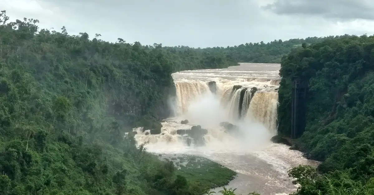
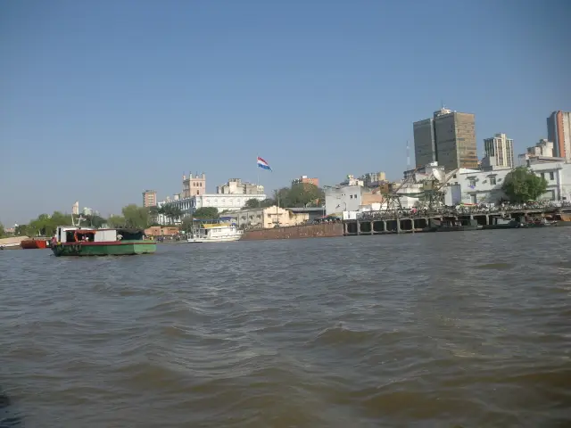
The geography of Paraguay is shaped by its landlocked position in the heart of South America and by the network of major rivers crossing its territory. The country is landlocked, bordering Argentina, Brazil, and Bolivia, with the capital, Asunción, situated on the banks of the Paraguay River. The Paraguay and Paraná rivers serve as both transport routes and dividers, splitting the country into distinct natural regions.
Contents
Paraguay’s landlocked location and characteristics
Paraguay is located in the centre of South America and is one of the few countries on the continent with no coastline. The territory borders Argentina to the south and southwest, Brazil to the east and northeast, and Bolivia to the northwest. Its deep inland location means all routes to the sea must pass through neighbouring countries.
The landlocked nature leaves a deep mark on the country of Paraguay, from trade to transport. Because there are no seaports, the country relies heavily on the river system to transport imports and exports down to the Río de la Plata estuary in Argentina and Uruguay. Therefore, the rivers are not just a natural feature but an economic lifeline.
Furthermore, its central location provides an advantage in road connectivity with major regional economies. Paraguay is a member of the Southern Common Market (Mercosur), so cross-border transport corridors with Brazil and Argentina play a vital role in the flow of agricultural goods and energy.
The shape of the territory is relatively compact and is not divided by high mountain ranges like many neighbouring Andean countries. Most of the area consists of plains and low plateaus, with elevation increasing towards the northeast. This gentle terrain facilitates large-scale farming, livestock rearing, and the construction of transport infrastructure.
Considering a residency programme? The Prosperous Living Investment team assesses your profile free of charge and advises on the pathway that fits your goals.
The Paraguay and Paraná rivers shape the territory
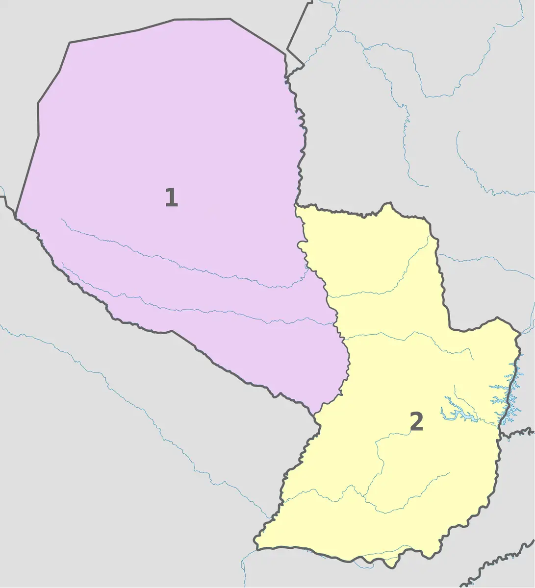
The two largest rivers dominating Paraguay’s geography are the Paraguay and Paraná rivers. The Paraguay River flows north to south, cutting the country almost in half and creating a natural boundary between the two major geographical regions. The capital, Asunción, is located on the eastern bank of this river, near where the Pilcomayo River flows into it.
The Paraná River flows along the eastern and southern borders, separating Paraguay from Brazil and then from Argentina for long stretches. This is one of South America’s major river systems, carrying abundant water volume and significant hydroelectric potential. The two rivers eventually converge in the south, near an important river port city.
The Paraguay-Paraná river system forms an inland waterway (hidrovía) stretching thousands of kilometres, connecting agricultural production areas with international markets. For a landlocked country, this network plays a role almost equivalent to a coastline, helping barge fleets transport soybeans, grains, and minerals to export ports.
In addition to the two main rivers, many tributaries such as the Pilcomayo and Tebicuary also contribute to the rich hydrological network. The rainy season often causes water levels to rise, sometimes causing flooding in low-lying areas along the rivers, while the dry season reveals vast alluvial plains.
The Pilcomayo River, originating in the Andes, is a special case: its flow carries significant sediment and frequently changes course, creating vast swamps and floodplains on the edge of the Gran Chaco. This river also serves as part of the natural border between Paraguay and Argentina in the southwest.
The river network not only serves transport but also deposits silt in low-lying areas, maintains soil moisture, and provides a foundation for riparian ecosystems. The seasonal rise and fall of water levels is a natural rhythm that governs many aspects of life in the lands along the waterways.
The fertile and populous eastern region
East of the Paraguay River is a region of lowlands interspersed with hills, collectively known as the eastern region or Eastern Paraguay (Región Oriental). This is the most fertile area, with abundant rainfall, land suitable for agriculture, and where the majority of the country’s population is concentrated.
Most major cities, including Asunción and its surrounding metropolitan area, are located in the eastern region. The landscape here consists of low plateaus, subtropical forests, grasslands, and farmland. This concentrated population distribution is linked to Paraguay demographics, as the vast majority of the population lives in the eastern territory.
The eastern region is also the centre of export agriculture, particularly soybean and grain cultivation, along with cattle ranching. Fertile land and a favourable climate make this the main engine of Paraguay’s economy, contributing significantly to the country’s total agricultural output.
In the northeast, near the border with Brazil, the terrain rises with hills and plateaus. This area once had significant forest cover, but the expansion of farmland over many decades has clearly altered the natural landscape towards agricultural use.
The nutrient-rich red basalt soil in some northeastern departments is the foundation for high crop yields, attracting waves of settlement and agricultural investment in recent decades. A dense network of rivers and streams, combined with stable rainfall, helps maintain soil moisture and reduces the risk of water shortages compared to the western Chaco region.
The urban network in the eastern region has developed along transport axes connecting Asunción with Ciudad del Este, a major city located near the Brazilian border and the Itaipú Dam. This urban-industrial corridor is where most of the country’s trade, services, and logistics activities are concentrated.
The arid and sparsely populated Gran Chaco to the west
West of the Paraguay River is the Gran Chaco region, also known as Western Paraguay (Región Occidental). This is a vast, flat plain that occupies the majority of the territory but is home to only a very small percentage of the population. The contrast between the eastern region and the Gran Chaco is one of the most striking features of Paraguay’s geography.
The Gran Chaco has a much hotter and drier climate than the eastern region. The characteristic landscape consists of thorny scrub forests, savannas, seasonal swamps, and arid lands. In the dry season, water is scarce over large areas; in the rainy season, some areas can become waterlogged due to poor drainage.
Due to harsh natural conditions, population density in the Gran Chaco is very low. However, the region still has significant economic importance, especially with extensive cattle ranching on large farms. Some settled communities, including German-origin Mennonite communities, have developed agriculture and dairy processing in the central Chaco region.
The Gran Chaco is also home to many indigenous groups and is an area of notable biodiversity, with many plant and animal species adapted to the arid environment. The conservation of the ecosystem here is receiving increasing attention in the face of pressure from the expansion of livestock and farming land.
As one moves northwest towards the border with Bolivia, the landscape becomes increasingly arid and sparse, with areas likened to semi-deserts. Summer temperatures in the Chaco can be among the highest in South America, while groundwater in many places is saline, making large-scale settlement and agricultural production difficult.
To overcome water shortages, the people of the Chaco have long relied on rainwater reservoirs, boreholes, and water conveyance works. Transport infrastructure in the region remains limited, with many dirt roads prone to becoming muddy during the rainy season, making connectivity between scattered settlements even more difficult.
Subtropical to tropical climate
The climate of Paraguay ranges from subtropical in the south and east to tropical in the north. Because it is landlocked, the country experiences more pronounced seasonal temperature variations than many coastal regions. Summers are hot and sometimes very humid, while winters are milder with occasional cold fronts sweeping through.
Rainfall is unevenly distributed across regions. The eastern region receives abundant rainfall throughout the year, which is favourable for crops and forests. Conversely, the Gran Chaco in the west is much drier, with a prolonged dry season and rainfall that decreases towards the northwest near the border with Bolivia.
Seasonal weather changes also affect river water levels and agricultural activity. Unusual droughts or heavy rainfall can impact agricultural yields and water levels on waterways, thereby affecting both transport and hydroelectric production.
Summer in Paraguay typically lasts from about October to March, coinciding with most of the annual rainfall, particularly through intense convective thunderstorms. Winter from May to August is drier and cooler, but cold fronts from the south can sometimes push temperatures down unexpectedly, especially in the south of the country.
Regional climate differences are directly reflected in vegetation and production patterns: the humid east is suitable for dryland crops and forests, while the arid Gran Chaco is better suited to grasslands and livestock farming. Understanding climate distribution is key to explaining why the population and economy are concentrated in the east.
Itaipú Dam and energy potential
One of the most prominent geographical features of Paraguay is the massive hydroelectric potential of the Paraná River. The Itaipú Dam, located on the border between Paraguay and Brazil, is one of the largest hydroelectric plants in the world in terms of power output. This facility is co-owned and jointly operated by the two countries.
Downstream, the Yacyretá Dam on the Paraná River is jointly exploited by Paraguay and Argentina, providing a significant additional source of electricity. Thanks to these facilities, Paraguay produces far more electricity than its domestic demand requires and has become an important exporter of clean energy in the region.
Abundant hydroelectric power is a rare natural advantage for a landlocked country. Cheap and plentiful electricity not only serves domestic consumption but also attracts energy-intensive industries. This is a factor that closely links the river geography to the country’s economic structure.
Besides hydroelectric power, the river system provides water for agriculture, domestic use, and the maintenance of riparian ecosystems. Sustainable management of transboundary water resources is therefore an important topic in Paraguay’s relations with its neighbours.
The location of major dams right on the border makes energy a sector intrinsically linked to regional diplomacy. Agreements on electricity output sharing and pricing between Paraguay, Brazil, and Argentina are issues of long-term economic significance, reflecting how river geography shapes international relations.
Abundant energy potential also opens up new development paths, from attracting processing and metallurgical industries to other energy-intensive sectors. In a world moving towards clean energy, Paraguay’s position as a source of almost entirely renewable hydroelectric power is increasingly gaining attention.
Agricultural land and natural resources
The most important resource of Paraguay is agricultural land, especially in the fertile eastern region. Rich soil combined with a favourable climate has turned the country into one of South America’s significant producers and exporters of agricultural products, with key commodities such as soybeans, grains, and beef.
According to international organisations such as World Bank, the Paraguayan economy relies heavily on agriculture and hydroelectric power, two sectors directly linked to natural geographical conditions. Official statistical data is published by the National Institute of Statistics of Paraguay, the agency responsible for population and economic figures.
Beyond arable land, vast grasslands in both the eastern region and the Gran Chaco facilitate a thriving livestock industry. Natural forests, although reduced, still provide timber and serve as reservoirs of biodiversity. The country’s mineral resources are considered more modest compared to some of its neighbours.
Resource distribution is linked to two natural regions: the east favours intensive agriculture and dense population, while the Gran Chaco to the west favours extensive livestock farming over large areas. This model clearly reflects the relationship between terrain, climate, and economic activity.
Besides land and water, a strategic resource of Paraguay is hydroelectric energy linked to the Paraná River system. This renewable resource, combined with vast agricultural land, creates the natural foundation for an economic model based on agriculture and clean energy.
The downside of agricultural wealth is the pressure on the environment. The expansion of soybean cultivation and livestock pastures has driven deforestation in both the eastern region and the Gran Chaco, reducing biodiversity and posing the challenge of balancing economic development with natural resource conservation.
Natural environment and conservation challenges
Paraguay’s ecosystem is quite diverse thanks to the transition between several natural regions: the Atlantic subtropical forest in the east, the flooded grasslands in the centre, and the thorny dry forest of the Gran Chaco in the west. Each region has its own flora and fauna, from jaguars and tapirs to many species of water birds in the marshes.
Deforestation is one of the most prominent environmental challenges. The Atlantic Forest in the east once covered a large area but has declined sharply due to agricultural expansion, while the dry Chaco forest also faces pressure from conversion to livestock pastures. This process impacts biodiversity and natural water cycles.
Seasonal wetlands, especially along the Paraguay River and the Ñeembucú region in the south, play an important role in flood regulation and serve as habitats for many species. Protecting these ecosystems is linked to water management and flood prevention for low-lying riverside areas.
Faced with these challenges, Paraguay has established protected areas and national parks to preserve representative landscape samples. Balancing the needs of agricultural development, energy, and nature conservation is one of the long-term challenges linked to the country’s specific geography.
Geography of Paraguay and the country’s natural regions
In terms of spatial organisation, the Paraguay River is the natural boundary dividing the country into two large regions: the eastern region and the western Gran Chaco region. This division is not only geographical but also reflects deep differences in population, economy, and landscape between the two halves of the territory.
The eastern region, although smaller in area, concentrates the majority of the population, economic activity, and major urban centres. Meanwhile, the vast Gran Chaco is sparsely populated, acting as an agricultural-livestock frontier with very low population density. This asymmetry is a characteristic feature when studying the geography of Paraguay.
Administratively, the territory is divided into several provinces (departamentos) along with the capital, Asunción, which holds a special status. This division somewhat follows natural features, with densely populated provinces concentrated in the east and large but sparsely populated provinces in the Chaco region.
In general, the country’s geography is a combination of its landlocked position, a large river network, and the east-west contrast. These factors have shaped how people live, produce, and connect with the outside world via waterways instead of the sea.
It can be summarised that the geography of Paraguay revolves around three major axes: its landlocked nature which forces the country to rely on rivers to reach the sea, the Paraguay-Paraná river system which both divides and connects the territory, and the east-west differentiation between the fertile, densely populated region and the arid, sparsely populated Gran Chaco. These three axes intertwine, governing everything from population distribution to economic structure.
Accompanying you on your journey in residency investment
The Prosperous Living Investment team advises on pathways, assesses profiles and manages investments transparently for every residency, citizenship and international property objective.
Free profile assessmentWhere life gets prosperous