


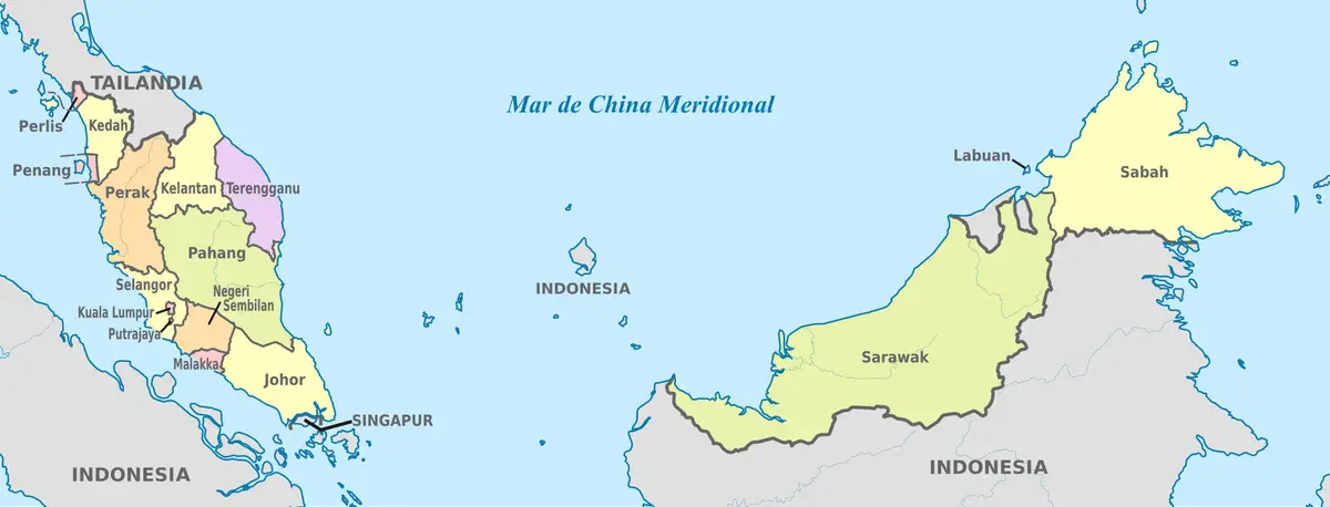
The geography of Malaysia is unique in that its territory is divided into two parts separated by the South China Sea: West Malaysia on the Malay Peninsula and East Malaysia on the island of Borneo. The capital, Kuala Lumpur, is located on the peninsula, which hosts the majority of the population and economic activity of this tropical country.
Contents
Location and territorial layout in Malaysia’s geography
One of the most prominent features of Malaysia’s geography is the division of its territory into two separate landmasses divided by a wide sea. These two blocks are commonly referred to as West Malaysia (or Peninsular Malaysia) and East Malaysia. The distance between them gives Malaysia a highly distinctive spatial structure in Southeast Asia.
West Malaysia occupies the southern part of the Malay Peninsula, extending in a north-south direction. To the north, the peninsula borders Thailand by land, while to the south, it is separated from Singapore by the narrow Johor Strait. This territory is densely populated, home to the capital Kuala Lumpur along with numerous major cities and key industrial and service centres.
East Malaysia is located in the northern and northwestern parts of the island of Borneo, comprising the two large states of Sabah and Sarawak. This region has a vast land area but a sparser population, with a heavily forested and mountainous terrain. The Malaysian portion of Borneo borders Indonesia and surrounds the small nation of Brunei, creating a complex border landscape between three countries on a single island.
This separation profoundly affects many aspects of life. Transport between the two parts relies mainly on air and sea, while differences in terrain, resources and population density have shaped distinct socio-economic characteristics for each region.
Considering a residency programme? The Prosperous Living Investment team assesses your profile free of charge and advises on the pathway that fits your goals.
West Malaysia: The Malay Peninsula
West Malaysia, or the Malay Peninsula, is a stretch of land connecting to mainland Asia via the border with Thailand. This is the region most commonly associated with Malaysia in the minds of many, as it is home to the capital and most of the modern urban network.
The peninsula’s terrain features a mountain range running along the north-south axis in the central part, commonly known as the Titiwangsa Range, which serves as a geographical backbone. This mountain range divides the peninsula into western and eastern slopes with distinct climates, river systems and economic development.
The western slope of the peninsula, facing the Strait of Malacca, has wider coastal plains and is home to the concentration of population as well as vibrant economic activity. The metropolitan area around Kuala Lumpur and the Klang Valley lies in this strip, forming the country’s most developed region.
The eastern slope facing the South China Sea typically features sandy coastlines, a lower population density and is more heavily influenced by the monsoon. The eastern coastal states retain much of their natural landscape and offer a slower pace of life compared to the bustling western coast.
According to World Bank, Malaysia’s position on the shipping lanes through the Strait of Malacca provides a vital geographical advantage for trade and maritime transport. The separation of its two territories by the South China Sea also creates a diverse range of terrain, ecology and population distribution between the Malay Peninsula and Borneo.
- Borders Thailand to the north by land.
- Separated from Singapore by the Johor Strait in the far south.
- The Titiwangsa Range runs along the centre of the peninsula.
- The west coast faces the Strait of Malacca, and the east coast faces the South China Sea.
East Malaysia: Sabah and Sarawak on the island of Borneo
East Malaysia comprises the two states of Sabah and Sarawak, located on the island of Borneo — one of the largest islands in the world, which Malaysia shares with Indonesia and Brunei. This is a vast but sparsely populated territory, famous for its rainforests, large rivers and rich ecosystems.
Sarawak is Malaysia’s largest state by area, stretching along the northwestern coast of Borneo. This region features many long rivers that serve as traditional transport arteries, winding through vast tropical rainforests and remarkable limestone cave systems.
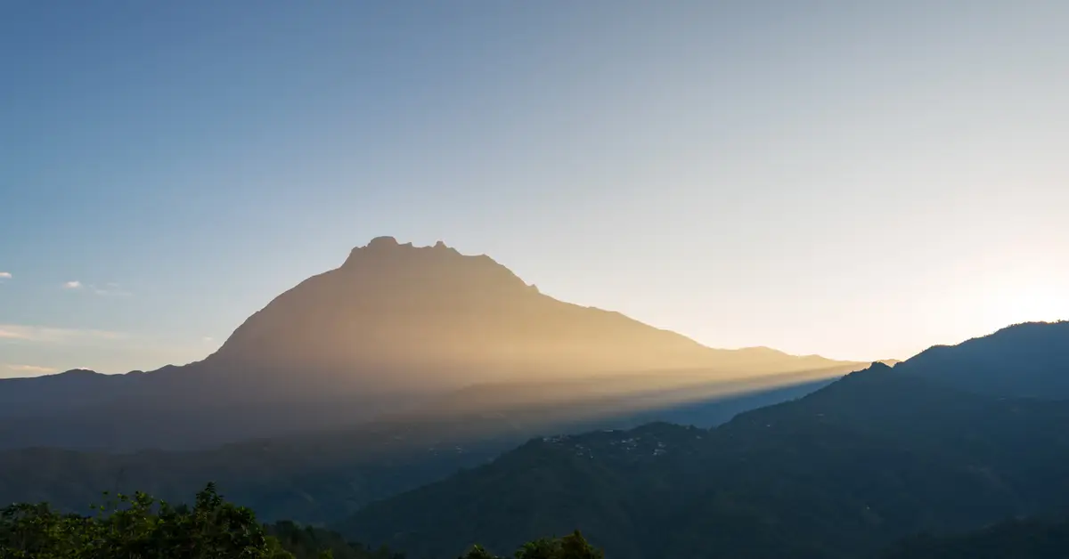
Sabah is located in the northeastern part of Borneo, known for its mountainous terrain and island-rich coastline. It is home to Mount Kinabalu, a famous high peak and a natural icon of the region. Sabah also boasts marine-rich waters that attract nature lovers and divers.
Compared to the peninsula, East Malaysia has a significantly lower population density and a diverse indigenous ethnic makeup. These two states hold a special position within the federal structure, linked to the history of joining the Federation of Malaysia, and possess substantial natural resources, including offshore oil and gas and forests.
The Strait of Malacca and its maritime role
The Strait of Malacca, located between the west coast of the Malay Peninsula and the Indonesian island of Sumatra, is one of the most important shipping lanes in the world. This position places Malaysia directly on the route connecting the Indian Ocean with the South China Sea and East Asia, which is a bustling maritime transport corridor.
For centuries, this strait has been a vital trade route between East and West. Ports along the coast once flourished due to their transit locations, and that heritage is still present in historic port cities marked by a unique cultural fusion.
Today, the Strait of Malacca remains a transit route for a very large portion of the world’s seaborne trade and energy. This strategic location provides a major advantage for Malaysia’s port, logistics and trade industries, while linking Malaysia’s geography to regional maritime security issues.
Besides its economic value, the strait has also shaped the history of settlement and urban development on the west coast of the peninsula. The connection between sea and land is a recurring theme when exploring the Malaysian economy and the country’s population distribution.
Tropical monsoon climate
Located close to the equator, Malaysia has a hot and humid tropical climate year-round with abundant rainfall. Minimal seasonal temperature variation, high humidity and heavy rainfall are the defining climatic features across the entire territory, from the peninsula to the island of Borneo.
Malaysia’s rainfall patterns are heavily influenced by monsoons. Alternating seasonal monsoons bring periods of heavy rain, particularly affecting the east coast of the Malay Peninsula and parts of East Malaysia, occasionally causing localised flooding.
In high-altitude areas such as around Mount Kinabalu or the peninsular highlands, the climate is significantly cooler than in the coastal plains. This elevation difference creates microclimates, forming famous highland resorts known for their pleasant climate.
The year-round hot and humid climate provides ideal conditions for the growth of tropical rainforests and tropical industrial crops. However, heavy seasonal rainfall also poses challenges for urban drainage, agriculture and disaster prevention in many localities.
Mount Kinabalu and mountainous terrain
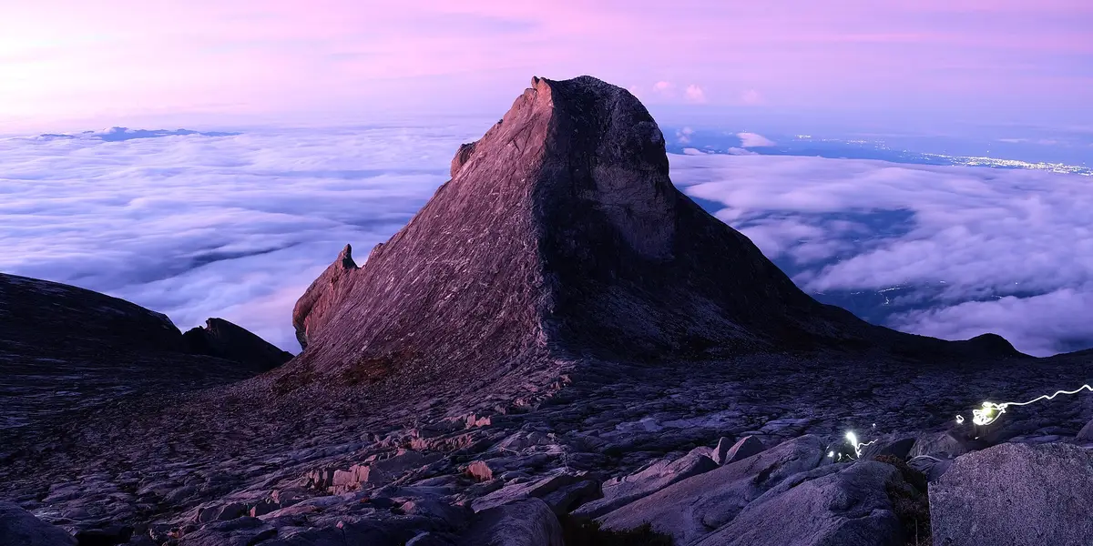
Mount Kinabalu in the state of Sabah is Malaysia’s prominent peak and one of the highest points in Southeast Asia. It is not only a geographical icon but also an important nature conservation area, known for its exceptional biodiversity.
The Mount Kinabalu region is recognised as a World Heritage site for its landscape and biodiversity values. It is home to many endemic plant and animal species, including unique wild orchids and carnivorous pitcher plants, attracting scientists and nature lovers alike.
Beyond Kinabalu, Malaysia’s topography features numerous other mountain ranges and highlands. On the peninsula, the Titiwangsa Range and highland areas create cool resort destinations. On the island of Borneo, mountainous and highland terrain stretches widely, dissected by river valleys.
The diverse topography, ranging from coastal plains to high mountains, has influenced population distribution and infrastructure development. Most residents are concentrated in the plains and coastal areas, while the mountainous regions serve as forests, water sources and nature conservation areas.
Tropical rainforests and biodiversity
Malaysia is home to some of the oldest and richest tropical rainforests on the planet. These forests cover a large part of the territory, particularly in East Malaysia on the island of Borneo, and are considered a global biodiversity treasure.
Malaysia’s rainforests are home to countless species of flora and fauna, including many rare and endemic species. Iconic species associated with Malaysia’s natural heritage include orangutans in Borneo, elephants, tigers, and a wide variety of unique birds, insects and plants.
Malaysia’s forest and marine ecosystems hold high conservation value. Alongside inland forests, coastal mangroves and offshore coral reefs play a crucial role in sustaining fishery resources and protecting coastlines from erosion.
However, Malaysia’s tropical forests also face pressure from agricultural development, logging and urbanisation. Balancing economic development with forest conservation is a long-term challenge, closely tied to environmental policies and efforts to preserve the country’s natural heritage.
- Ancient tropical rainforests, exceptionally rich in Borneo.
- Home to orangutans, elephants, tigers and many endemic species.
- Coastal mangroves and coral reefs of high ecological value.
- Under pressure from agriculture, logging and urbanisation.
Rivers, coastlines, and natural resources
River systems play an important role in Malaysia’s geography, especially in East Malaysia where many long rivers serve as traditional transport routes through the jungle. On the peninsula, although the rivers are shorter, they still provide water and silt to the coastal plains.
With a structure comprising a peninsula and two island states, Malaysia possesses a long coastline and numerous islands of various sizes. The diverse coast, ranging from sandy beaches and bays to mangrove forests, creates favourable conditions for fisheries, marine tourism, and port development. Many offshore islands are popular tourist destinations.
Natural resources are closely linked to the country’s geography. Malaysia has offshore oil and gas, particularly around Borneo, along with forest resources and land suitable for tropical industrial crops such as oil palm and rubber. This distribution of resources helps shape the economic structure of each region.
Geographical location, climate, and resources together form the foundation for population and production. To understand how people are distributed and live across this space, reference can be made to Malaysia demographics alongside natural factors.
Population distribution and major cities
Malaysia’s population is unevenly distributed, clearly reflecting the country’s geographical characteristics. Most of the population is concentrated in West Malaysia, particularly along the west coast of the Malay Peninsula, which features favourable plains and a long history of urban development.
The metropolitan area around the capital Kuala Lumpur and the Klang Valley is the most populous and bustling region, serving as the political, economic, and cultural hub. Alongside this is the administrative centre of Putrajaya, together with numerous port and industrial cities along the west coast of the peninsula.
In East Malaysia, the population is sparser and concentrated in a few coastal cities and lowlands along rivers. The vast mountainous and forested terrain leaves many inland areas of Sabah and Sarawak with low population densities, home to diverse indigenous ethnic communities.
The contrast in population distribution between the two territories is a core characteristic when viewed as a whole Malaysia. It governs infrastructure layout, development planning, and connectivity between the peninsula and Borneo.
Accompanying you on your journey in residency investment
The Prosperous Living Investment team advises on pathways, assesses profiles and manages investments transparently for every residency, citizenship and international property objective.
Free profile assessmentWhere life gets prosperous