

The geography of Hungary is characterised by its landlocked status in the heart of Central Europe, featuring vast plains, two major rivers—the Danube and the Tisza—the famous Lake Balaton, and an abundance of geothermal hot springs that is rare in the region.
Contents
Location and landlocked characteristics of Hungarian geography
Hungary is a landlocked country in Central Europe with no coastline. The capital, Budapest, is located near the centre of the northern part of the country, on the Danube River. This landlocked nature shapes much of how Hungary connects to the world: all waterborne trade routes depend on the river system and neighbouring countries.
Its central location makes Hungary a junction for many road and rail routes connecting Western Europe with the Balkans and Eastern Europe. The territory is relatively compact, extending more in an east–west direction than north–south. To better understand the overall picture, readers can refer to more information about Hungary in the thematic series.
As a member of the European Union and the Schengen Area, Hungary’s geographical location offers transit advantages. However, being landlocked also imposes certain logistical limitations compared to countries with deep-water ports.
In terms of scale, Hungary is a medium-sized European country, with most of its territory located within the Carpathian Basin. A large portion of the area lies at a low altitude above sea level, which explains why flat terrain predominates. Its deep inland location also means the country’s climate and hydrology are more strongly influenced by continental air masses than by the ocean.
Considering a residency programme? The Prosperous Living Investment team assesses your profile free of charge and advises on the pathway that fits your goals.
Neighbouring countries and borders
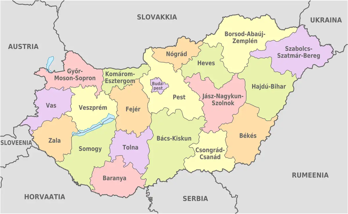
Hungary shares borders with seven countries, a high number relative to its size. To the west is Austria, to the north is Slovakia, to the northeast is Ukraine, and to the east is Romania. In the south, Hungary borders Serbia, Croatia, and Slovenia.
Having many neighbours reflects the complex history of the Carpathian Basin, where borders have changed many times over the centuries. Most current borders run through relatively flat terrain or follow natural rivers, rather than rugged mountain ranges.
This diversity of neighbours facilitates cross-border cultural and commercial exchange. At the same time, it explains why ethnic Hungarian communities now live in many border regions of surrounding countries.
- West: Austria
- North: Slovakia
- Northeast: Ukraine
- East: Romania
- South: Serbia, Croatia, and Slovenia
Plains and the Great Hungarian Plain
Hungary’s terrain is primarily plains and lowlands, making it one of the flattest countries in Central Europe. The largest area is the Great Hungarian Plain (Alföld), which stretches across the east and southeast of the Danube. This is a fertile agricultural region, associated with the characteristic puszta grassland imagery.
Beyond the Danube lies the Transdanubia (Dunántúl) region, with gently rolling terrain and low hills interspersed with valleys. To the northwest is the Little Plain (Kisalföld), a smaller but equally fertile plain.
Hungary’s hilly and mountainous areas are relatively modest in height. The range of hills and low mountains in the north, near the border with Slovakia, is where the country’s highest points are concentrated. However, even these peaks are considered low-to-medium when compared to Europe’s major mountain ranges.
The Alföld plain and low plateaus
The Great Alföld Plain is not only the largest geographical region but also a landscape symbol of Hungary. Stretching between the Danube and the eastern border, this region is almost perfectly flat, with fields and grasslands extending to the horizon. The puszta grasslands here were once traditional livestock grazing spaces and still retain special cultural value today.
In the north, the terrain gradually transitions into hills and low plateaus on the southern edge of the Carpathians. This area is more rugged, with forests and valleys, contrasting sharply with the flatness of the Alföld. It is this contrast that creates a diverse topographical cross-section, even though the distances between regions are not great.
The difference in altitude between the plains and the low plateaus is small in numbers but clearly shapes land use. The lowlands are favourable for large-scale farming, while the northern hills are more associated with forests, vineyards, and traditional extraction activities.
The Danube, the Tisza, and the hydrological network
The two major rivers dominating Hungary’s hydrological system are the Danube and the Tisza. The Danube flows from north to south, passing through the capital, Budapest, and dividing the country into two parts: east and west. It is an important international waterway, connecting Hungary with many countries along the basin.
The Tisza, a major tributary of the Danube, winds through the eastern part of the country and plays a vital role in the agriculture of the plains. The network of canals, river branches, and wetlands associated with these two rivers creates a rich wetland ecosystem.
Abundant water resources not only serve irrigation but also influence population distribution and urbanisation. Many of Hungary’s major cities, including Budapest, were formed and developed along these rivers. The connection between geography and life is also reflected in Demographics of Hungary.
Both the Danube and the Tisza are transboundary rivers, originating or flowing through many countries before entering Hungary. This characteristic makes flood management and water quality a regional issue, requiring cooperation between countries along the basin. Hungarian history has recorded many projects to regulate flow and build dykes to limit flooding in the low-lying plains.
Lake Balaton and notable lakes
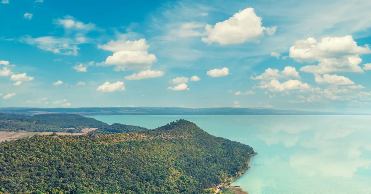
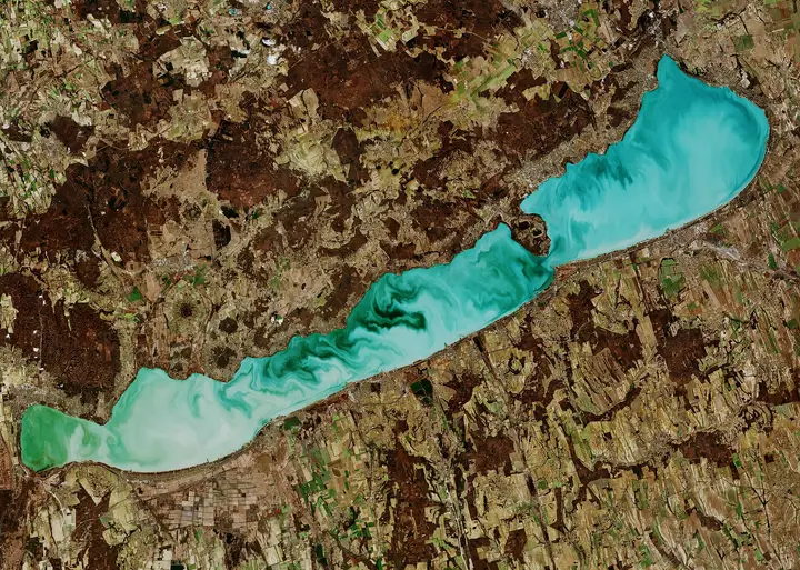
Lake Balaton is a large freshwater lake in Hungary and ranks among the largest in Central Europe by surface area. Located in the Transdanubia region, Balaton is a popular holiday destination known for its shallow shores, warm water in summer, and numerous bustling lakeside towns.
Besides Balaton, Hungary is home to Lake Hévíz, a natural thermal lake widely known for its geothermal properties. Lake Velence and Lake Tisza (an artificial reservoir on the Tisza River) are also significant bodies of water that serve tourism and ecological purposes.
These lakes not only create scenic landscapes but also contribute significantly to the domestic tourism economy. Their role in economic life is analysed in more detail in the article on the Hungarian economy.
A common characteristic of large lakes in Hungary is their relatively modest depth compared to their surface area, which helps the water warm up quickly in summer but also makes them sensitive to weather fluctuations. The area around Balaton is also notable for its vineyard-covered hills and historic towns, creating a tourism and ecological complex that is closely intertwined.
Hot springs and geothermal potential
A prominent feature of Hungary’s geography is the abundance of thermal water sources and geothermal energy. Thanks to the unique geological structure of the Pannonian Basin, the Earth’s crust in this region is relatively thin, causing underground temperatures to rise rapidly with depth.
As a result, Hungary possesses numerous hot mineral springs distributed throughout the country, including within the capital, Budapest. The tradition of mineral bathing has been established for centuries, leaving behind a system of famous historic baths. This is also a heritage closely linked to local life.
Beyond its value for relaxation, geothermal sources are also harnessed for heating and some energy production. This potential is considered a special resource advantage for the country, although the specific level of exploitation may vary over time.
Compared to many other European countries, the density of thermal water sites in Hungary is among the highest, making it one of the region’s notable thermal spa tourism centres. Hot groundwater is also being studied for agricultural greenhouse applications and district heating, aiming for more sustainable exploitation of underground resources.
Temperate continental climate with seasonal variations
Hungary has a temperate continental climate with four distinct seasons. Summers are typically warm to hot, while winters are cold and can drop below freezing. Its landlocked location results in a significant temperature range between seasons due to the lack of the moderating influence of the sea.
Rainfall is relatively evenly distributed throughout the year but tends to be higher in late spring and early summer. The western region is generally more humid than the eastern plains, which sometimes experience dry spells. This difference directly affects agricultural seasons.
In recent decades, Hungary has also recorded more extreme weather phenomena, ranging from prolonged heatwaves to heavy local rainfall. Monitoring climate trends is a key factor for water resource and agricultural land management.
The change of seasons in Hungary is quite distinct: spring warms up with plenty of rain, while autumn is cool and often features pleasant, dry periods. This seasonal characteristic not only dictates the farming calendar but also shapes the tourism season, as lake and thermal spa regions are busiest during the warmer months of the year.
Agricultural land resources and land use
Fertile soil is one of Hungary’s most important natural resources. Most of the country’s land is used for agriculture, especially the Great Plain region with its nutrient-rich black soil. Key crops include cereals, maize, sunflowers, and fodder crops.
In addition to cultivation, Hungary has a long-standing tradition of winemaking with many famous wine regions. The soil and climate conditions in certain areas are highly suitable for viticulture, creating branded products.
Hungary’s mineral resources are relatively limited compared to its agricultural and geothermal potential. Therefore, a development path based on agriculture, tourism, and geothermal energy is considered appropriate for the country’s geographical characteristics. The national statistical agency of Hungary is the Hungarian Central Statistical Office which publishes extensive data related to land use and agricultural production.
Biodiversity and national parks
Although its territory is not very large, Hungary still possesses significant biodiversity thanks to the combination of grasslands, wetlands, lakes, rivers, and hilly forest regions. The wetlands along the Danube and Tisza rivers are important habitats for many waterbirds and serve as stopovers on migratory routes.
The country has a system of national parks spread across different geographical regions, protecting both the puszta grassland landscapes and aquatic ecosystems. These areas have both conservation value and serve environmental education and ecotourism, helping to preserve the characteristic landscapes of the Central European plains.
Biodiversity conservation in Hungary is linked to the sustainable management of water and land resources. Pressures from intensive agriculture, climate change, and urbanisation pose challenges in balancing economic development with the preservation of natural ecosystems.
Geographical zoning and natural landscapes
In terms of landscape, Hungary can be divided into major geographical regions based on terrain and hydrology. The Great Plain in the east, the Transdanubia region in the southwest, the Little Plain in the northwest, and the low mountain ranges in the north are easily recognisable landscape units.
Each region has its own nuance: the vast grasslands and fields of the Alföld, the vineyard hills and forests of Transdanubia, and the lake landscapes around Balaton. This diversity, even within a relatively small territory, creates significant ecological and tourism value.
Many natural areas are protected in the form of national parks and reserves. According to international organisations such as World Bank, the sustainable management of land and water resources is a long-term challenge for agricultural countries in Central Europe, including Hungary.
Accompanying you on your journey in residency investment
The Prosperous Living Investment team advises on pathways, assesses profiles and manages investments transparently for every residency, citizenship and international property objective.
Free profile assessmentWhere life gets prosperous