


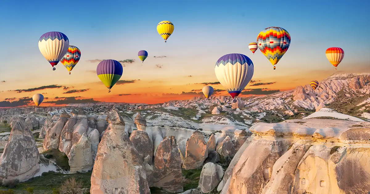
Turkey’s geography is one of the most distinctive cases on the world map. It is a transcontinental country, with 97% of its territory in Asia and 3% in Europe, separated by a strategic system of straits linking the Black Sea with the Mediterranean. Its position at the meeting point of the Balkans, the Caucasus, the Middle East and the Eastern Mediterranean has made this country one of the most important bridges throughout human history.
A detailed article onthe country of Turkey.
Message
Geographical position and national area
Turkey lies between latitudes 36 and 42 degrees North and longitudes 26 and 45 degrees East. Most of its territory is the Anatolian peninsula (Anadolu), also known as Asia Minor, stretching along an east-west axis. The remainder is called Eastern Thrace (Trakya), in the extreme south-east of Europe, the remnant of an empire that once covered most of the Balkans.
Theo CIA World Factbook, the total area ofTurkeyis 783,562 km², of which 769,632 km² is land and 13,930 km² water. The country ranks 37th in the world by area, larger than the United States state of Texas, larger than France and Britain combined, and 2.5 times the size of Italy.
The longest distance from west to east is 1,600 km, and from north to south around 650 km. This elongated shape creates a rare diversity of climate and landscape.
İskilip, a small town in Çorum province in Central Anatolia, was once measured and determined to be the geographical centre of the Earth on certain calculation criteria. Although symbolic, this reflects the country’s central position on the map of Eurasia.
Considering a residency programme? The Prosperous Living Investment team assesses your profile free of charge and advises on the pathway that fits your goals.
Land borders and coastline
Turkey has a total land border of 2,648 km, adjoining 8 countries. To the east it borders Armenia for 268 km, Azerbaijan for 9 km through the Nakhchivan exclave, Iran for 499 km and Georgia for 252 km. To the south-east it borders Iraq for 352 km and Syria for 822 km — the country’s longest land border.
To the north-west, its European territory borders Greece for 206 km and Bulgaria for 240 km. The borders with Greece and Bulgaria were established by the Treaty of Constantinople of 1,913 and later confirmed by the Treaty of Lausanne of 1,923.
The country’s coastline runs 7,200 km, meeting four different seas. The Black Sea surrounds it to the north, the Mediterranean to the south, the Aegean to the west and the Sea of Marmara to the north-west. This long and varied coastline is the foundation for strongly developed tourism, fishing and maritime transport industries.
The most distinctive feature of Turkey’s geography is the system of straits linking the Black Sea with the Mediterranean, comprising the 31 km Bosphorus, the Sea of Marmara and the 65 km Dardanelles. Istanbul — the country’s largest city — straddles the Bosphorus, making it the only metropolis in the world lying on two continents. Under the Montreux Convention of 1,936, the country controls passage through the straits, giving it particular geopolitical leverage.
The seven distinctive geographical regions of Turkey
The First Geographical Congress held in Ankara from 06/06 to 21/06/1941 divided the territory into 7 main geographical regions. The criteria for division were climate, position, vegetation, fauna, agricultural production, transport and terrain. This regional division is still used officially today.
The four coastal regions are named after the neighbouring seas: Marmara, Aegean, Mediterranean and Black Sea. The three inland regions — Central Anatolia, Eastern Anatolia and South-Eastern Anatolia — are named after their position within the peninsula.
The Marmara region in the north-west is the most industrialised and densely populated. Although it covers only 8.5% of the area, it holds more than 30% of the country’s population, with Istanbul as its economic engine. The Aegean region in the west is famous for ancient cities such as Ephesus, Pergamon, Bodrum and İzmir — the country’s third largest city.
The Mediterranean region in the south has famous coastal cities such as Antalya and Mersin and the magnificent Taurus mountains. The Black Sea region in the north is the wettest, famous for Trabzon tea production, hazelnuts and rugged forested mountain landscapes. Central Anatolia with the capital Ankara is the administrative centre, with a vast plateau and a harsh continental climate.
The Eastern Anatolia region is the highest, with the harshest climate and the lowest population density. The South-Eastern Anatolia region has the driest climate, and is the cradle of the world’s first agriculture with archaeological sites such as Göbekli Tepe.
Terrain and the mountain systems
More than 80% of Turkey’s area is hills and mountains, with an average elevation of 1,132 metres. The general terrain is mountain ranges surrounding the central Anatolian plateau, with mountain ranges and narrow coastal plains in the peripheral areas.
The Pontic Mountains (Kuzey Anadolu Dağları) run parallel to the Black Sea coast in the north, forming a natural wall 1,525 to 1,800 metres high in the west and 3,000 to 4,000 metres in the east. This range entirely separates the narrow coastal plain from the interior plateau.
The Taurus range runs parallel to the Mediterranean coast in the south, with many peaks above 3,000 metres. To the north-east, the Pontic and Anti-Taurus ranges converge to form the rugged Eastern Anatolian plateau.
Mount Ararat (Ağrı Dağı) is the country’s highest peak at 5,137 metres, in Ağrı province near the Armenian and Iranian borders. According to biblical tradition, this is where Noah’s Ark came to rest after the great flood. Ararat together with Nemrut Dağı and Tendurek Dağı are three volcanoes historically active, but which have not erupted since the 19th century or earlier.
The Anatolian plateau in the centre has an average elevation of 600 to 1,200 metres. The western part of the plateau is relatively flat, becoming more rugged and higher towards the east. The country’s lowest point is the Mediterranean sea level, with the Çukurova plain in the south one of the most fertile and productive areas.
Climate and the distinctive features of Turkey’s geography
Turkey’s climate is diverse because of its large area, complex terrain and contact with four seas. In general, the coastal areas have a temperate climate while the interior has a harsher continental climate.
The Mediterranean and Aegean coasts have a typical Mediterranean climate, with hot dry summers and mild wet winters. Average temperatures in Istanbul range from 4°C in winter to 27°C in summer. Tourist cities such as Antalya, Bodrum and Marmaris have warm sunshine almost year round.
The Black Sea region has a humid maritime climate with the highest rainfall in the country. Rize on the eastern Black Sea coast receives more than 2,500 mm of rain a year, creating lush forest landscapes year round. This region is also the only one with no distinct dry season.
The interior Anatolian plateau has a continental climate with a wide temperature range. Ankara has hot dry summers up to 30°C and cold winters below minus 10°C, with heavy snowfall. The Eastern Anatolia region has the harshest climate, with Erzurum regularly recording winter temperatures below minus 30°C.
This climatic diversity creates the conditions for a rich agriculture. The country is one of the few able to grow almost every tropical and temperate crop, from tea, oranges, olives and grapes to wheat, barley and sugar beet.
Rivers and lake systems
Turkey is the headwaters of many major rivers flowing into neighbouring countries. The Euphrates (Fırat), 3,596 km long, rises in the eastern mountains and flows through Syria and Iraq before reaching the Persian Gulf. The Tigris (Dicle), 1,950 km long, also rises here and runs parallel down into Iraq.
Because it controls the headwaters of the Middle East’s two most important rivers, the country’s role in regional water resource management is very significant. The GAP project (Güneydoğu Anadolu Projesi) in South-Eastern Anatolia is one of the world’s largest irrigation and hydroelectric projects, with dozens of dams and hydroelectric plants built.
The other major rivers are the Kızılırmak at 1,355 km — the longest river flowing entirely within the country — the Sakarya at 824 km, and the Aras flowing along the Armenian and Azerbaijani borders. Most rivers have seasonal flows with widely varying volumes because of the mountainous terrain.
Lake Van in Eastern Anatolia is the country’s largest lake at 3,740 km² and 1,546 metres above sea level. It is one of the world’s largest endorheic lakes, with alkaline saline water because it has no outlet. Lake Tuz in Central Anatolia is the second largest salt lake at 1,640 km², supplying around 70% of the country’s salt consumption.
Natural resources and land
Turkey has abundant mineral resources thanks to its diverse geology. The main minerals are coal, iron ore, copper, chromium, antimony, mercury, gold, barite, borates, celestite, gypsum, marble and perlite. The country is a world-leading producer of marble and borates, holding around 73% of global borate reserves.
On land use, on 2,018 figures, agricultural land accounts for 49.7% of the area, of which arable land is 26.7%, permanent crops 4% and pasture 19%. Forest accounts for 14.9%, with the remaining 35.4% other land including urban, industrial and unused land.
Hydroelectricity is the main renewable energy source, accounting for around 20% of total electricity output. Solar and wind potential is also very large, and is being strongly developed under the national energy strategy to 2,053.
Earthquakes and natural risks
Its distinctive geology places Turkey in one of the most seismically active zones in the world. According toRepublic of Türkiye Ministry of Foreign Affairs, the country lies between three major tectonic plates: the Eurasian, Arabian and African plates.
The North Anatolian Fault, around 1,500 km long, runs almost parallel to the Black Sea coast and is one of the most active geological faults in the world. The East Anatolian Fault and the Aegean fault also cause frequent earthquakes.
History records many catastrophic earthquakes. The İzmit earthquake of 1,999, magnitude 7.6, killed more than 17,000 people. Most recently, the twin Kahramanmaraş earthquakes of 06/02/2023, magnitude 7.8 and 7.5, killed more than 50,000 people in the south and south-east of the country.
The government has rolled out many programmes to improve earthquake-resistant construction standards. Major cities, particularly Istanbul, have received heavy investment in seismic-resistant infrastructure and early warning systems.
Geopolitical standing and strategic value
Its distinctive geographical position has made Turkey a vital trading crossroads throughout history. The country controls three strategic trade routes: the maritime route through the Bosphorus and Dardanelles, the land route linking Europe with the Middle East, and the oil and gas pipelines from the Caucasus and Central Asia.
The Baku-Tbilisi-Ceyhan oil pipeline carries oil from Azerbaijan across the country’s territory to the Mediterranean. The TANAP and TurkStream pipelines carry gas from Azerbaijan and Russia to Europe. This energy transit role brings significant revenue and considerable geopolitical leverage.
Major seaports such as Istanbul, Izmir, Mersin and Iskenderun are important trade gateways between Europe, Asia and Africa. Istanbul Airport, opened in 2,018, is one of the world’s largest transit airports, serving more than 76 million passengers in 2,024.
This geographical advantage also drives location-related economic sectors such as tourism, logistics and financial services. For international investors, theTurkey citizenship by investmentprogramme allows property ownership in prime locations such as Istanbul and Antalya — cities of particular geographical value.
Conclusion
Turkey’s geography is a distinctive synthesis of many factors: a transcontinental position bridging Asia and Europe, a strategic system of straits, an area of 783,562 km² with 7 diverse geographical regions, more than 80% hills and mountains, 7,200 km of coastline and borders with 8 neighbouring countries. This diversity creates both great economic opportunity and significant natural risk, particularly earthquakes.
Understanding this country’s geography not only helps in assessing tourism and investment potential but also explains why this land has always been the meeting point of many civilisations over 12,000 years. Its strategic position and diverse resources continue to shape the country’s role in the 21st century.
Accompanying you on your journey in residency investment
The Prosperous Living Investment team advises on pathways, assesses profiles and manages investments transparently for every residency, citizenship and international property objective.
Free profile assessmentWhere life gets prosperous