

Geography of the United States

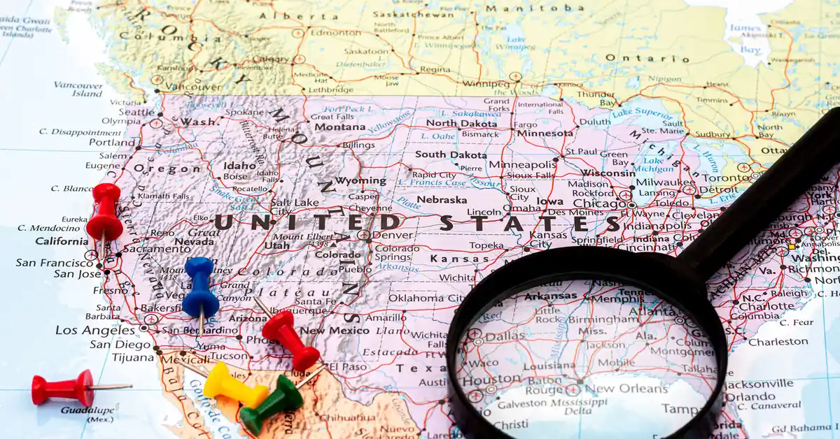
The geography of the United States is one of the most important factors contributing to the nation’s strength. With an area of 9.83 million km², ranking 3rd in the world after Russia and Canada, the country possesses almost every type of terrain, from Arctic ice in Alaska to tropical rainforests in Hawaii, and from the hottest desert in the Western Hemisphere, Death Valley, to the 6,190-metre peak of Denali.
The diversity of US geography spans 50 continental and island states, along with 5 inhabited overseas territories. The 19,924 km coastline — the largest in the world — borders the Atlantic Ocean, the Pacific Ocean, the Gulf of Mexico, and the Arctic Ocean. The 6,275 km Mississippi-Missouri river system is the country’s vital agricultural transport artery. This article provides a panoramic overview of US geography based on official data from U.S. Geological Survey (USGS) and the Census Bureau. This is an extension of the page United States overview.
Message
Geographic location and borders
The continental United States is located in the centre of North America, stretching from longitude 67°W (eastern Maine) to 124°W (western Washington), and from latitude 24°N (the tip of Florida) to 49°N (the border with Canada). The state of Alaska is located separately in the northwest of the continent, with longitude extending to 172°E. The Hawaiian Islands are located in the middle of the Pacific Ocean, approximately 3,860 km from the West Coast of California.
Border with Canada
The northern border with Canada is 8,891 km long — the longest international border in the world. The border follows the 49th parallel north from Lake of the Woods (Minnesota) to Boundary Bay (Washington), passing through the states of Minnesota, North Dakota, Montana, Idaho, and Washington. The eastern section of the border passes through the Great Lakes system and the St. Lawrence River to Passamaquoddy Bay in Maine. Alaska alone has an additional 2,475 km of border with the Canadian provinces of Yukon and British Columbia.
Border with Mexico
The southern border with Mexico is 3,145 km long, running through four states: California, Arizona, New Mexico, and Texas. Most of this border follows the Rio Grande (Río Bravo del Norte in Mexico) — a natural river 3,051 km long. The remaining section is a land border established after the Treaty of Guadalupe Hidalgo in 1848. This is the most vibrant trading area in North America, with 50 official ports of entry and 350 million crossings each year.
Coastline and oceans
The total coastline length reaches 19,924 km, the longest in the world due to the complex coastlines of Alaska and the Hawaiian Islands. The East Coast borders the Atlantic Ocean from Maine to Florida, with major ports in New York, Boston, Norfolk, and Miami. The West Coast borders the Pacific Ocean, with ports in Seattle, San Francisco, Los Angeles, and San Diego. The South Coast borders the Gulf of Mexico, with ports in Houston and New Orleans. The northern coast of Alaska borders the Arctic Ocean.
Considering a residency programme? The Prosperous Living Investment team assesses your profile free of charge and advises on the pathway that fits your goals.
Area and classification
According to USGS data, the total national area is 9,833,520 km² including water. Of this, the land area is 9,147,420 km² and the water area is 685,924 km² (including the US portion of the Great Lakes, the Great Salt Lake, major rivers, and coastal waters).
International comparison
In terms of national land area, the United States ranks third in the world after Russia (17.1 million km²) and Canada (9.98 million km²), approximately 240,000 km² larger than China (9.60 million km²). However, when considering land area only, China is larger because the United States has a greater surface water area. The area of the United States is 29 times that of Vietnam (331,690 km²), 36 times that of the United Kingdom, and 24 times that of Germany.
Classification of the 50 states by area
Among the 50 states, Alaska is the largest with 1,717,856 km² – accounting for nearly one-fifth of the entire country and 2.5 times the size of Texas (695,662 km², ranked second). Next are California (423,971 km²), Montana (380,831 km²), and New Mexico (314,917 km²). The smallest state is Rhode Island with only 4,001 km², roughly the size of Hanoi. The District of Columbia (Washington D.C.) covers only 177 km². The significant disparity in area between the states reflects the diversity of the system of 50 states and territories of the United States.
Four main geographic regions
The Census Bureau divides the contiguous United States into four major regions: Northeast, Midwest, South, and West. Each region has distinct economic, cultural, and climatic characteristics.
Northeast Region
The Northeast consists of nine states: Maine, New Hampshire, Vermont, Massachusetts, Rhode Island, Connecticut, New York, New Jersey, and Pennsylvania. This is the most populous and densely populated region with approximately 57 million people. Located along the Atlantic coast and south of the Great Lakes, this region is a hub for finance, education, and technology, featuring cities such as New York, Boston, and Philadelphia. It is also the cradle of the 13 colonies and home to many Ivy League universities. The climate is temperate with snowy winters and humid summers.
Midwest Region
The Midwest consists of 12 states: Ohio, Indiana, Michigan, Illinois, Wisconsin, Minnesota, Missouri, Iowa, Kansas, Nebraska, South Dakota, and North Dakota. With a population of approximately 68 million people, this is the “Wheat Belt” and “Corn Belt” of the world. Major cities include Chicago, Detroit, Indianapolis, Columbus, and Milwaukee. The Midwest is also the traditional industrial belt currently undergoing transformation (the Rust Belt). The climate is humid continental with harsh, cold winters and hot summers.
South Region
The South is the most populous region with approximately 130 million people, comprising 16 states and the District of Columbia: Delaware, Maryland, Virginia, West Virginia, Kentucky, Tennessee, North Carolina, South Carolina, Georgia, Florida, Alabama, Mississippi, Arkansas, Louisiana, Oklahoma, and Texas. This region has the fastest population growth rate due to migration from the Northeast and Midwest (Sun Belt migration). It is a centre for oil and gas (Houston), aviation (Atlanta), tourism (Florida), and technology (Austin, Research Triangle in North Carolina). The climate is humid subtropical in the East, semi-arid in Texas, and tropical in South Florida.
West Region
The West consists of 13 states: Montana, Idaho, Wyoming, Colorado, New Mexico, Arizona, Utah, Nevada, California, Oregon, Washington, Alaska, and Hawaii. The total population is approximately 80 million people, with the majority concentrated in California (39 million), Washington (8 million), and Arizona (7 million). This is the most geographically diverse region, ranging from the temperate rainforests of Washington to the Death Valley desert, and from the icy peaks of Denali to the tropical beaches of Hawaii. Silicon Valley in California is a global technology hub with a major influence on the United States economy modern.
Terrain and mountains
The geography of the United States has a relatively simple yet diverse terrain structure: two major mountain ranges running parallel North-South on the East and West coasts, with a vast plain in between. This structure facilitates the world’s largest agricultural sector and an efficient transcontinental transport system.
Appalachian Mountains in the East
The Appalachian Mountains run for 2,400 km from Alabama to Newfoundland (Canada), with a width of 160-480 km. These are among the oldest mountains in the world, formed 480 million years ago. The highest peak is Mount Mitchell in North Carolina at 2,037 metres. The mountain range includes characteristic sections: the White Mountains in New Hampshire, the Green Mountains in Vermont, the Catskill Mountains in New York, the Blue Ridge from Pennsylvania to Georgia, and the Great Smoky Mountains on the Tennessee-North Carolina border. The area west of the Appalachians is the Allegheny Plateau, which is rich in coal, oil, and gas.
Rocky Mountains in the West
The Rocky Mountains stretch 4,800 km from British Columbia (Canada) to New Mexico, with a width of up to 480 km. Formed 80 million years ago, this is a young mountain range with high peaks and steep slopes. Mount Elbert in Colorado at 4,401 metres is the highest point of the range. The Continental Divide splits the drainage system into two sides: the East drains into the Gulf of Mexico via the Mississippi River, and the West drains into the Pacific Ocean via the Columbia and Colorado Rivers.
Sierra Nevada and Cascade Ranges
The Sierra Nevada runs for 644 km through the state of California with Mount Whitney at 4,421 metres – the highest point in the contiguous 48 states outside of Alaska. North of the Sierra Nevada is the Cascade Range, which runs through Oregon and Washington with volcanoes such as Mount Rainier (4,392m), Mount Hood (3,429m), and Mount St. Helens (which erupted in 1980). West of the Cascades is the Pacific Northwest, which contains the only temperate rainforest outside of the Southern Hemisphere.
Denali Peak in Alaska
Mount Denali (formerly Mount McKinley) in Alaska is 6,190 metres high – the highest peak in all of North America. The peak is located in the 24,500 km² Denali National Park. The climate is harsh with temperatures of -60°C in winter. Only 1,200 people climb Denali each year, with a 50% success rate. Comparison: Mount Everest is 8,848 metres high, but Denali has a “prominence” (vertical distance from base to peak) of more than 5,500 metres, and many climbers rank it as a more difficult peak than Everest.
Deserts and the Grand Canyon
The Southwest features the Great Basin, including Death Valley in California – the lowest point in North America at -86 metres below sea level and the hottest place recorded on Earth (56.7°C in 1913). The Mojave Desert lies between California, Nevada, Arizona, and Utah. The Sonoran Desert in Arizona is home to many iconic saguaro cacti. The Grand Canyon in Arizona is 446 km long, 29 km wide, and 1,857 metres deep – a masterpiece of erosion by the Colorado River over 6 million years.
River and lake systems
The geography of the United States boasts one of the world’s most abundant river and lake systems, playing a vital role in freight transport, electricity production, and water supply for agriculture.
Mississippi-Missouri River System
The Mississippi River is 3,766 km long, running from Minnesota to the Gulf of Mexico in Louisiana, passing through 10 states. The Missouri River (3,767 km, the main tributary) meets the Mississippi in St. Louis. The total length of the Mississippi-Missouri system is 6,275 km, the fourth largest in the world after the Nile, Amazon, and Yangtze Rivers. The river basin covers 41% of the area of the contiguous 48 states. This is the most important freight transport route in North America with 500 million tonnes of cargo per year, primarily grain, coal, and oil.
Colorado and Columbia Rivers
The 2,330 km long Colorado River provides water for seven Southwestern states and Mexico, serving as the primary water source for Los Angeles, Phoenix, and Las Vegas. The Hoover Dam on the Colorado River created Lake Mead – one of the largest artificial lakes in North America. The 2,000 km long Columbia River runs through British Columbia, Washington, and Oregon, emptying into the Pacific Ocean. It is the river with the largest hydroelectric capacity in North America, featuring more than 14 major dams.
The Great Lakes
The Great Lakes consist of five lakes: Superior, Michigan, Huron, Erie, and Ontario – containing 21% of the world’s surface freshwater, with a total area of 244,106 km². All lakes except Michigan form the shared border between the US and Canada. Lake Superior is the world’s largest freshwater lake by area (82,103 km²). The Great Lakes port system connects to the Atlantic Ocean via the St. Lawrence Seaway, allowing ocean-going vessels to reach Chicago, Detroit, Cleveland, and Buffalo.
Great Salt Lake
The Great Salt Lake in Utah is the largest saltwater lake in the Western Hemisphere, with a salinity 5-8 times higher than seawater. Its area fluctuates seasonally from 2,500 to 8,500 km². The lake is a remnant of the ancient 51,000 km² Lake Bonneville from the Ice Age. The lake level is falling critically due to drought and agricultural water consumption, threatening the regional ecosystem.
Climate zones
With an area spanning 50 degrees of latitude and 60 degrees of longitude, the geography of the United States contains almost every climate type according to the Köppen classification. This diversity provides the foundation for the world’s largest agricultural sector by export value.
Temperate continental climate
Most of the Northeast and Midwest regions have a humid continental climate with four distinct seasons. Winters are cold, with temperatures ranging from -10°C to -25°C in Chicago and Minneapolis, while summers are warm at 25-30°C. Annual rainfall of 800-1,200 mm is evenly distributed. This region is subject to the “Polar Vortex” — cold air from the Arctic that descends each winter, causing severe blizzards. Summers bring tornadoes in “Tornado Alley,” stretching from Texas to North Dakota.
Humid subtropical climate
The Southeastern United States, from Virginia to Texas, has a humid subtropical climate with long, hot, and humid summers of 30-35°C and mild winters of 5-15°C. Annual rainfall is 1,200-1,600 mm. This region is prone to devastating Atlantic Hurricanes annually, particularly in Florida, Louisiana, and Texas. Hurricane Katrina in 2005 in New Orleans was the costliest natural disaster in history, with 1,833 deaths and US$125 billion in damages.
Mediterranean, desert, and temperate rainforest
The California coast has a Mediterranean climate with hot, dry summers and warm, humid winters. San Francisco is cooler due to the California Current, while Los Angeles and San Diego are warm year-round. The interior Southwest (Nevada, Arizona, New Mexico, Utah) is desert and semi-arid. The Pacific Northwest (Washington, Oregon) features temperate rainforests with rainfall reaching up to 4,000 mm per year in the Olympic Mountains.
Alaska and Hawaii
Alaska has three climate zones: subarctic in the south (Anchorage, Juneau), continental subarctic in the interior (Fairbanks), and Arctic on the North Slope. Temperatures in Fairbanks range from -50°C in winter to 25°C in summer. Hawaii has a tropical climate with stable temperatures of 20-30°C year-round, with high rainfall on the windward side and dry conditions on the leeward side. The summit of Mauna Kea on the Big Island, at 4,207 metres — the highest peak in Hawaii — can experience snow in winter despite being at 19°N latitude.
Overseas territories
Beyond the 50 states and the District of Columbia, U.S. geography also includes five inhabited overseas territories and several uninhabited small islands.
Puerto Rico
Puerto Rico is the largest territory with an area of 9,104 km² and a population of 3.2 million — double that of all other territories combined. Located in the Caribbean, the island has a tropical climate with two seasons: wet and dry. Residents of Puerto Rico have been U.S. citizens since 1917 but do not vote in Presidential elections. The capital, San Juan, is one of the largest cruise ports in the Caribbean.
Guam and the Northern Mariana Islands
Guam is located in the Western Pacific, with an area of 549 km² and a population of 168,000. It is a vital military outpost housing the Navy base and Andersen Air Force Base. The Northern Mariana Islands consist of 14 islands, with an area of 464 km² and a population of 47,000. Both territories are key stopovers for the U.S. Navy in the Western Pacific as part of the Indo-Pacific strategy.
U.S. Virgin Islands and American Samoa
The U.S. Virgin Islands (USVI) in the Caribbean have an area of 346 km² and a population of 87,000. American Samoa in the South Pacific has an area of 199 km² and a population of 45,000. Residents of American Samoa have a special status as “U.S. National” (not citizen), unlike other territories. All five territories have a non-voting delegate in the U.S. House of Representatives.
Natural resources
The diversity of U.S. geography provides abundant natural resources that rank among the best in the world, serving as the foundation for the nation’s economic strength.
Oil, natural gas, and coal
The United States has been the world’s largest crude oil producer since 2018, with production reaching 13.2 million barrels per day in 2024. The shale revolution in the early 2010s, driven by fracking technology, transformed the nation from a major importer into a net energy exporter. The state of Texas (Permian Basin) and New Mexico are the two primary production regions. Coal reserves are the largest in the world at 250 billion tonnes, concentrated in Wyoming, West Virginia, and Kentucky. Natural gas production is the highest globally.
Metallic minerals
The United States is rich in diverse metallic minerals: gold and silver in Nevada (Goldstrike and Cortez mines), copper in Arizona and Utah (Bingham Canyon mine), molybdenum in Colorado, uranium in Wyoming, and zinc in Alaska. However, rare earths are dependent on imports (80% from China) — a strategic weakness that the government is addressing by boosting domestic extraction through the Critical Minerals Act.
Agricultural land
The United States has 1.62 million km² of agricultural land — the largest in the world. The Midwest is the “breadbasket” with nutrient-rich alluvial soil from the Mississippi-Missouri river system. Key products include soybeans (world leader), corn (world leader), wheat (top 4), beef, pork, dairy, and poultry. Total agricultural exports reached US$170 billion in 2024, ranking second after China.
Forests and 63 National Parks
Approximately 33% of U.S. territory is forested (3.1 million km²), concentrated in the Pacific Northwest, the Southeast, and Alaska. The National Park Service manages 63 National Parks — from Yellowstone (the world’s first national park, 1872), Yosemite, and the Grand Canyon to Denali. The total protected national area exceeds 340,000 km², attracting 325 million visitors per year. This is an important part of American culture and a top destination for the Vietnamese community travelling domestically.
For Vietnamese investors interested in residency by investment in the United States, understanding U.S. geography helps in choosing a state that suits business conditions, preferred climate, and community connections. California, Texas, Florida, and Washington are the four states most chosen by Vietnamese people due to their large communities and diverse business opportunities.
Accompanying you on your journey in residency investment
The Prosperous Living Investment team advises on pathways, assesses profiles and manages investments transparently for every residency, citizenship and international property objective.
Free profile assessmentWhere life gets prosperous