

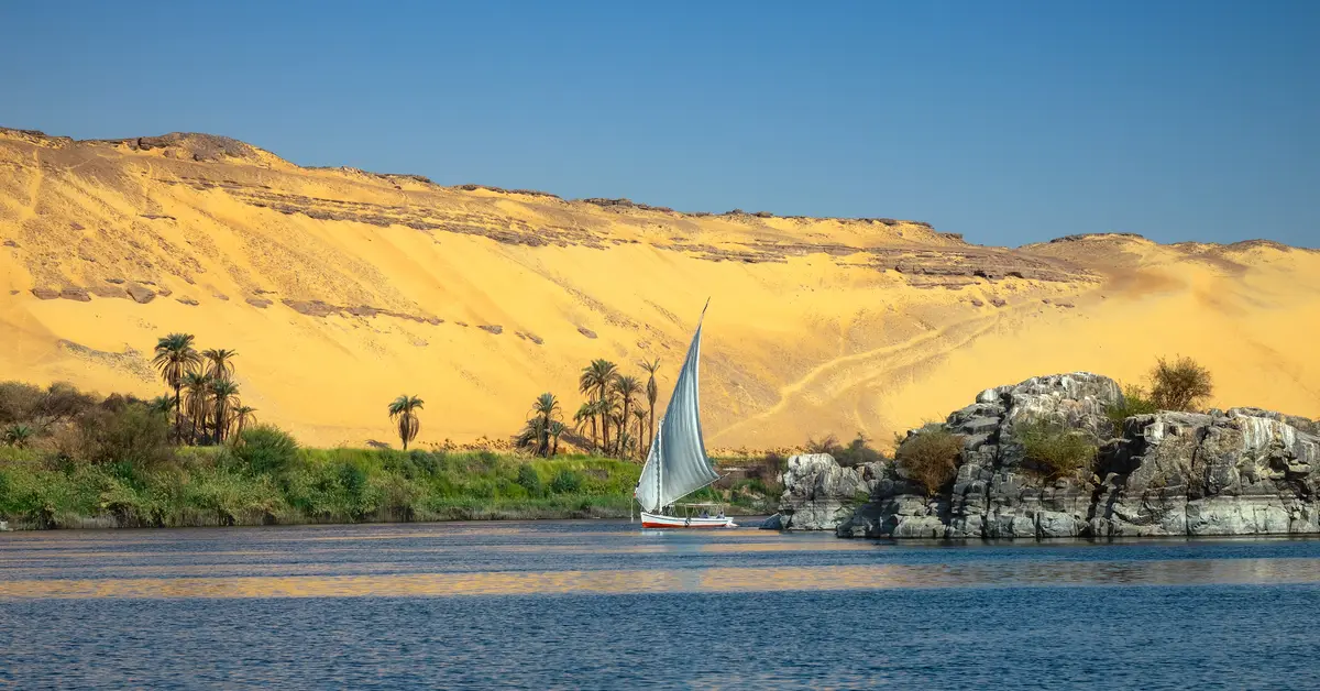
The geography of Egypt shapes the entire life of this nation: a strip of North African land bordering the Mediterranean and the Red Sea, where the lush Nile cuts across the vast Sahara sand sea. Most of the territory is desert, yet the population is concentrated in the fertile Nile valley and delta.
Contents
Location and general characteristics of Egypt’s geography
When discussing the geography of Egypt, the first point to grasp is the country’s rare transcontinental position. Most of Egypt’s territory lies in the north-east corner of Africa, but the Sinai Peninsula belongs to Asia. Consequently, Egypt is one of the few countries that spans two continents, acting as a hinge between North Africa, the Middle East and the Mediterranean.
The capital, Cairo, is located near the apex of the Nile Delta, where the river branches out before flowing into the sea. This central position helps Cairo connect conveniently with both the upper reaches to the south and the coastal region to the north. This is also why the city has become the most important administrative, residential and transport hub in the region.
Furthermore, Egypt possesses a dual coastline: the north faces the Mediterranean Sea, while the east borders the Red Sea. These two seas, together with the Isthmus of Suez, create a strategic trade corridor connecting the Atlantic Ocean and the Mediterranean with the Indian Ocean, thereby shaping the country’s unique geopolitical position.
Considering a residency programme? The Prosperous Living Investment team assesses your profile free of charge and advises on the pathway that fits your goals.
Borders and neighbouring countries
Egypt has clearly defined land borders and coastlines due to its natural terrain. To the north, the country faces the Mediterranean with an extensive coastline. To the east, the Red Sea and the Gulf of Aqaba form a natural boundary, while also opening up a busy maritime route leading down to the Indian Ocean.
On land, Egypt borders Libya to the west, Sudan to the south, and Israel and the Gaza Strip to the north-east of the Sinai Peninsula. Most land borders follow conventional straight lines across the desert, reflecting the sparse population and lack of natural obstacles in the interior.
This location makes Egypt a transit point between Africa and Western Asia. The Sinai Peninsula, connecting the African portion with the Levant region, has long been a bridge for trade and human migration. To understand the broader picture, readers can refer to further information on Egypt within the related articles system.
According to World Bank, the majority of Egypt’s population and economic activity is concentrated along the Nile Valley and Delta, while the vast desert regions are almost uninhabited. This characteristic makes the actual population density in habitable areas among the highest in the world, despite the country’s large total area.
The Nile, the lifeblood of Egypt’s geography
No single factor shapes Egypt’s geography as profoundly as the Nile. It is one of the longest rivers in the world, flowing from south to north and emptying into the Mediterranean. The water winds through the desert, creating a narrow green strip amidst the arid sea of sand, often likened to a gift from nature to the country.
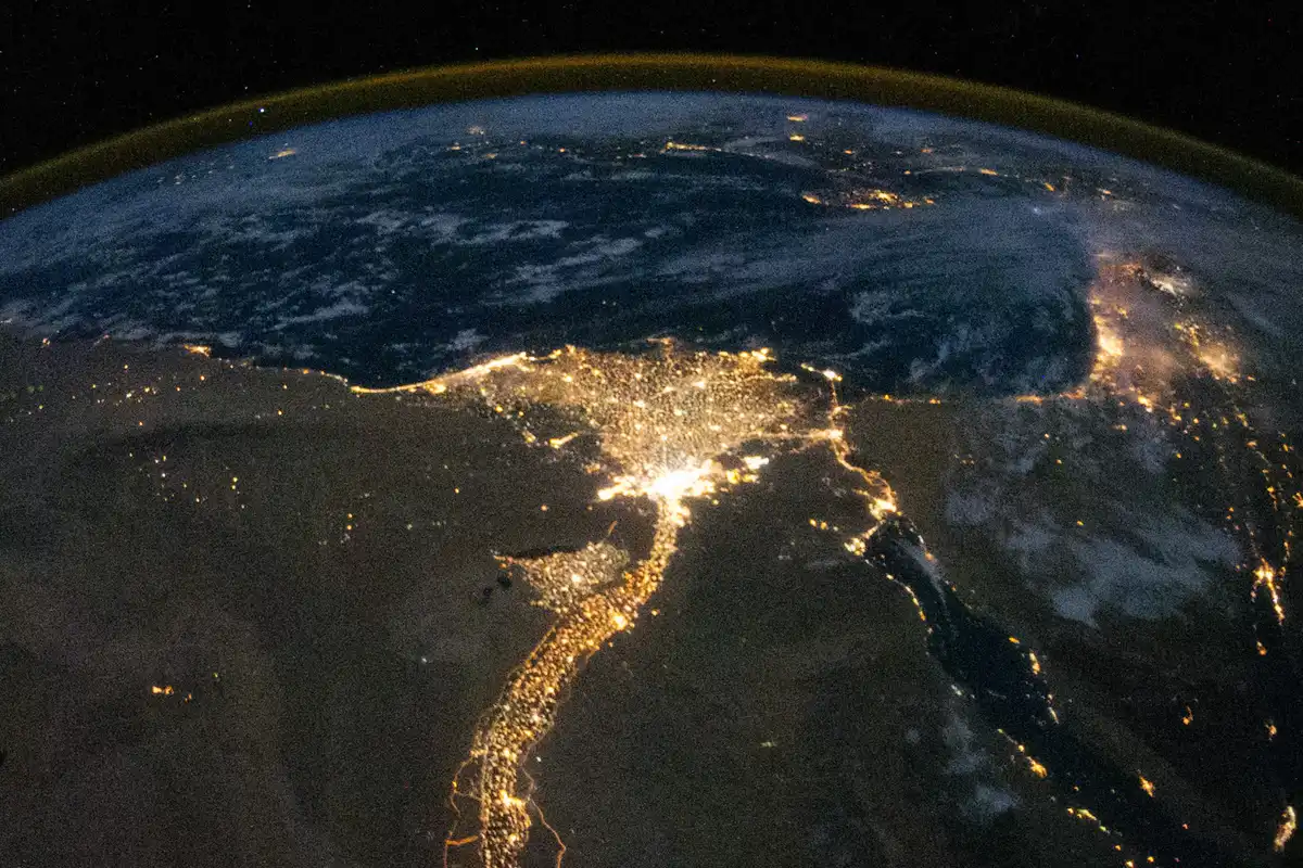
The Nile Valley and the vast delta in the north are home to fertile land enriched by silt deposited over thousands of years. It is here that the majority of Egypt’s population lives, farms and builds cities. Although it occupies only a small fraction of the total territory, the strip of land along the river is the centre of almost all economic and social activity.
Controlling and regulating the flow is of vital importance. The High Dam at Aswan helps regulate floods, store water for the dry season and generate electricity, significantly changing the rhythm of traditional agriculture that once depended on seasonal flooding. The close connection between the river and production explains why geography is so intimately linked to the Egyptian economy.
In addition, the Nile is an important inland waterway, connecting regions along the length of the country. From the headwaters in the south to the delta in the north, the river binds together population centres, markets and monuments, creating a backbone for both the geographical and historical space of the nation.
The delta and population distribution
As it nears the Mediterranean, the Nile fans out, creating a vast delta in the north. This is one of the world’s most famous and densely populated alluvial plains, with a dense network of canals for irrigation. The land here is flat, low-lying and highly favourable for cultivation.
The contrast between the green land along the river and the surrounding desert is the most noticeable feature. The population is densely concentrated along the valley and delta, while the vast desert regions are almost empty. Population density in the riverside cities is among the highest in the world, even though the figure is much lower when calculated across the entire territory.
Major cities such as Cairo, Alexandria and Giza are all located in or near this area. This population concentration creates significant pressure on housing, infrastructure, clean water and arable land. This distribution pattern is directly related to the picture of Demographics of Egypt, which is strongly influenced by natural geographical factors.
Deserts and vast topographical regions
Most of Egypt’s area is desert, part of the Sahara Desert system that stretches across North Africa. From east to west, the territory is generally divided into two large desert regions separated by the Nile Valley. These are arid, sparsely populated spaces with little rainfall, yet they are by no means monotonous in terms of terrain.
The Western Desert occupies a vast area west of the Nile, stretching to the Libyan border. This region consists of rocky plateaus, vast seas of sand and several depressions with groundwater, where small clusters of inhabitants and orchards have formed in the middle of the desert. The oases have long been important stopovers on trans-desert routes.
The Eastern Desert lies between the Nile and the Red Sea and has more rugged terrain with coastal mountain ranges. This area is rich in minerals and was once a site for stone and metal extraction in ancient times. The steep terrain sloping towards the Red Sea creates a sharp contrast to the flat delta region.
The Sinai Peninsula in the east has its own distinct topographical features, with arid rocky mountains in the south and sandy plains that slope gently towards the north. The high peaks of Sinai are among the most prominent geographical features of the country and are associated with many long-standing historical and religious values.
The Suez Canal and the Red Sea
The Suez Canal is a man-made geographical project of global significance. The canal cuts across the Isthmus of Suez, connecting the Mediterranean in the north with the Red Sea in the south. Consequently, ships can travel from Europe to Asia without having to sail around the southern tip of Africa, significantly shortening the distance and transport time.
The location of the canal makes Egypt a key link in international maritime trade. A significant portion of the goods traded between continents passes through this route. Revenue from transit fees is one of the country’s important pillars of foreign currency, linking geography to economic destiny.
Beyond its transport value, the Red Sea is famous for its coral reef ecosystem and coastal resorts. The eastern coastline has become an important tourist destination, taking advantage of the year-round sunny climate and clear blue water. This is a testament to how natural geography is harnessed for modern development.
Hot and arid desert climate
Egypt has a typical hot and arid desert climate, with very little rainfall across most of its territory. Summers are long, with intense sun and high temperatures, while winters are milder but still dry. The temperature difference between day and night in the desert region is often quite large, characteristic of an arid continental climate.
The Mediterranean coastal strip in the north enjoys a milder climate, with rainfall concentrated in winter and higher humidity due to the influence of the sea. The further one travels inland and south, the harsher the climate becomes and the rarer the rain. It is this scarcity of rainfall that makes the Nile a vital source of fresh water.
During the transitional seasons, some hot winds carrying sand and dust can blow from the desert, reducing visibility and affecting daily life. However, in general, the stable sunny climate is an advantage for irrigated agriculture and for the tourism industry, which attracts visitors seeking year-round warmth.
Natural resources and land
Although most of the territory is desert, Egypt still possesses significant natural resources. The country has reserves of oil and natural gas, concentrated in areas such as the Western Desert, the Gulf of Suez and offshore in the Mediterranean. This is an important energy source for both domestic consumption and export.
Beyond energy, the deserts and mountainous regions contain various mineral resources such as iron ore, phosphate, limestone, and many types of construction stone. These deposits have been exploited for a very long time, providing materials for architectural projects across many eras. The Red Sea region is also known for its abundant mineral potential.
Arable land resources are relatively scarce, as they are concentrated only in the strip of land along the Nile and its delta. Population pressure makes agricultural land precious, driving projects to reclaim and expand irrigation areas into the desert. Balancing the protection of fertile land with urban development is a long-term geographical challenge.
Fresh water is the most sensitive resource. Almost the entire water demand depends on the Nile, so any fluctuations in upstream flow have strategic significance. Effective water management is therefore a core issue, closely linking natural geography with the nation’s security and sustainable development.
- Oil and natural gas are found in the western desert region, the Gulf of Suez, and offshore in the Mediterranean Sea.
- Minerals such as iron ore, phosphate, limestone, and construction stone are found in the mountainous and desert regions.
- Fertile arable land is concentrated in the Nile valley and delta.
- Fresh water sources are almost entirely dependent on the Nile.
Spatial organisation and main geographical regions
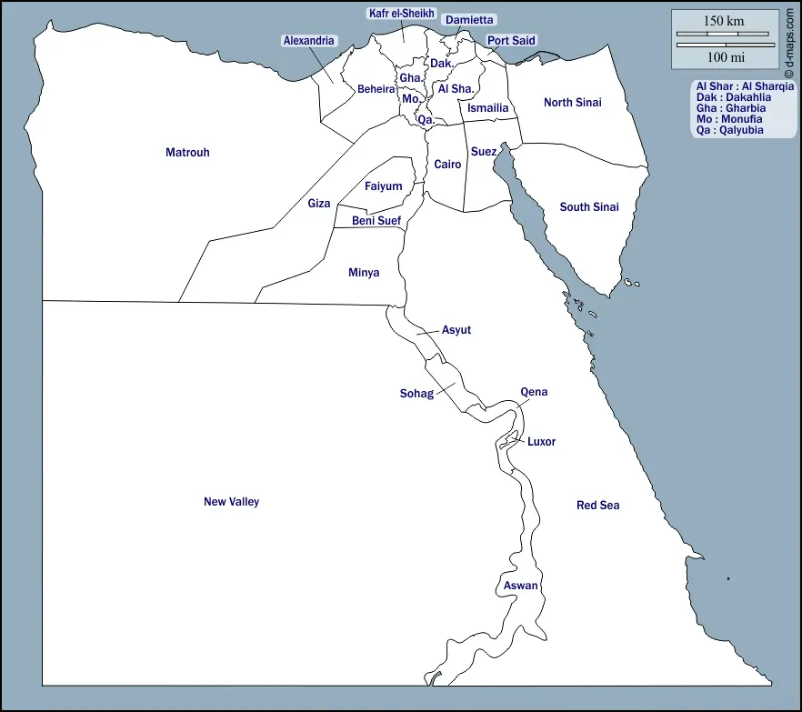
Spatially, Egypt can be visualised as consisting of several distinct major geographical regions. The central axis is the Nile valley and delta, where the population and production activities are concentrated. On either side are vast desert regions, while to the east lie the Sinai Peninsula and the Red Sea coastal strip.
This natural organisation is clearly reflected in the distribution of urban areas and the transport network. Roads, railways, and residential areas primarily follow the river and the coastline, where water and arable land are available. Meanwhile, the desert interior has only sparse routes connecting oases and resource extraction sites.
The connection between terrain, water sources, and people makes geography the foundation for understanding many other aspects of the country. From population distribution and urbanisation to regional development orientation, everything stems from the reality of a desert nation living off a single river.
By understanding this natural landscape, readers will easily connect with more in-depth topics regarding population, economy, and society, all of which bear the distinct mark of this specific geographical environment.
Accompanying you on your journey in residency investment
The Prosperous Living Investment team advises on pathways, assesses profiles and manages investments transparently for every residency, citizenship and international property objective.
Free profile assessmentWhere life gets prosperous