


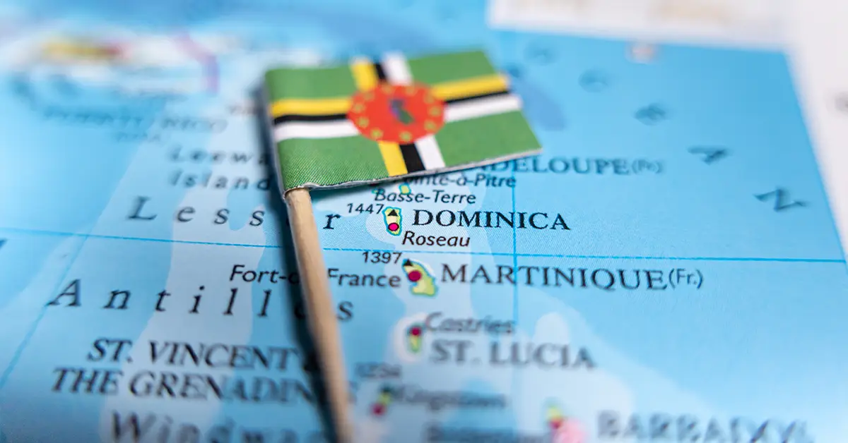
The geography of Dominica is unusual in the Caribbean: a volcanic island with rugged, mountainous terrain and one of the richest tropical rainforest ecosystems in the Lesser Antilles. The island nation covers 750 km², is 47 km long and up to 26 km wide, with its highest point, Morne Diablotins, rising 1,448 m above sea level.
Dominica’s geography plays a key role in shaping the history, economy and identity ofDominica. The harsh volcanic terrain helped the Indigenous Kalinago resist European colonisation for centuries and is today the country’s most important ecotourism asset.
Message
Location within Dominica’s geography and national borders
Dominica lies in the Windward Islands chain of the Lesser Antilles in the eastern Caribbean. The island’s central coordinates are about 15.3° North and 61.4° West. This location places the island nation between two French overseas territories: Guadeloupe to the northwest and Martinique to the south-southeast.
Dominica is 40 km from Guadeloupe and 35 km from Martinique. It is about 600 km north of Caracas (Venezuela) and about 2,000 km south of Miami (United States). The coastline is 148 km long in total, with small bays and rocky headlands creating a varied coastal landscape. The island nation has no disputed territory, and its maritime boundaries are clearly delimited under the United Nations Convention on the Law of the Sea.
Considering a residency programme? The Prosperous Living Investment team assesses your profile free of charge and advises on the pathway that fits your goals.
Terrain and volcanic origins
Geologically, Dominica is among the youngest volcanic islands in the whole of the Lesser Antilles, with tectonic activity still ongoing. The island sits on the convergent boundary between the Caribbean Plate and the North American Plate, where the North American Plate subducts beneath the Caribbean Plate to form the Lesser Antilles volcanic arc.
The country has 9 potentially active volcanoes, the highest concentration by land area of anywhere in the world. Morne Diablotins in the north, at 1,448 m, is the highest peak, while Morne Trois Pitons in the south, at 1,387 m, is the centrepiece of the national park of the same name. Other notable peaks include Morne Watt (1,224 m), Morne Anglais (1,123 m) and Morne Plat Pays (940 m).
Remaining evidence of geothermal activity includes fumaroles (volcanic gas vents), hot springs, boiling lakes and steaming ground around the Valley of Desolation. The most recent recorded activity was at Boiling Lake in 2004, when steam and sulphur gases escaped from the lake surface. The whole island has only narrow coastal plains, with more than 90% of its area mountains and forest.
Climate and rainfall
Climate is an important factor in Dominica’s geography: it is tropical maritime, with stable temperatures all year and high rainfall. Average daytime temperatures range from 26°C in January to 32°C in June. In high mountain areas, temperatures can drop to 13°C at night. Average humidity remains between 75% and 85%.
The dry season runs from February to May, while the rainy season from June to October coincides with the Atlantic hurricane season. Rainfall varies sharply with terrain, from 1,500 mm on the dry west coast to more than 6,350 mm in the mountainous interior. This is among the highest rainfall in the Caribbean and feeds the island’s abundant river system.
Tropical storms are a recurring risk in Dominica’s geography, with the two most severe recent hurricanes being David (1979) and Maria (2017). Category 5 Hurricane Maria made landfall on 18/9/2017 with winds of 260 km/h, causing damage equivalent to 226% of GDP and destroying 90% of buildings. The event prompted the government to adopt a comprehensive climate resilience strategy for Dominica in the decades ahead.
Rivers and lakes
A notable feature of Dominica’s geography is the island nation’s famous saying “365 rivers for 365 days of the year”, although the exact number depends on how a “river” is defined. The main rivers flow from the central highlands to the sea in all four directions; they are short (mostly under 10 km) but have high flow rates due to steep terrain and heavy rainfall.
The Roseau River is the largest river, flowing into the sea at the capital of the same name on the west coast. The Layou River in the north is the longest. The Indian River is famous for rowing-boat tours through mangrove forest and appeared in Disney’s Pirates of the Caribbean films.
Boiling Lake in Morne Trois Pitons National Park is the world’s second-largest natural hot lake, 60 m across, with surface temperatures of 82°C to 92°C. Freshwater Lake, at an altitude of 762 m, is the largest freshwater lake and supplies water for the country’s hydroelectric power. The smaller Boeri Lake, near Freshwater Lake, sits in an old volcanic crater.
Flora and fauna
Dominica’s geography supports one of the most diverse tropical rainforest ecosystems in the Caribbean. Primary forest covers about 60% of the country, with forest types layered by altitude: lowland rainforest, montane rainforest, cloud forest and xerophytic upland forest.
The island is home to 1,226 identified plant species, many of them endemic. The national flower is the Bois Caribe (Sabinea carinalis), with its brilliant red blossoms. The Dominica orchid (Schomburgkia thomsoniana) is the endemic national orchid of the mountainous interior.
The fauna includes two famous endemic parrots. The Sisserou or imperial parrot (Amazona imperialis) is found only in Dominica and is the national symbol on the flag. The red-necked parrot or Jaco (Amazona arausiaca) is also found only here. The country has 175 bird species, 55 species of reptiles and amphibians, and rich marine life around the coral reefs of the west coast. The mountain chicken frog (Leptodactylus fallax) was once the national dish but has become critically endangered due to chytrid fungus disease.
National parks and protected areas
Dominica has one of the most developed national park systems in the Caribbean, with three main national parks. Morne Trois Pitons National Park, covering 70 km² in the south of the island, wasinscribed by UNESCO as a World Heritage Sitein 1997, the first national park in the Caribbean to receive this designation. It includes Boiling Lake, the Valley of Desolation, the Emerald Pool and many famous waterfalls.
Cabrits National Park in the north protects coastal dry forest and historic 18th-century French and British forts. Morne Diablotin National Park protects the country’s highest peak and a key habitat of the Sisserou parrot. The Central Forest Reserve and the Northern Forest Reserve also play an important role in conserving biodiversity.
Champagne Reef on the southwest coast is a marine reserve famous for volcanic gas bubbles rising from the seabed, creating a “sparkling champagne” effect while snorkelling over the coral. About 22% of the country’s land area is protected in one form or another.
Administrative divisions
The island nation is divided into 10 administrative parishes inherited from the British colonial system. The ten parishes are: Saint Andrew, Saint David, Saint George, Saint John, Saint Joseph, Saint Luke, Saint Mark, Saint Patrick, Saint Paul and Saint Peter. Saint George Parish contains the capital Roseau and is the most densely populated.
Roseau is the capital and largest city, with about 14,500 people, on the southwest coast at the mouth of the Roseau River. The city is the main port and the administrative and financial centre. Portsmouth is the second-largest town, with about 3,500 people, on the northwest coast at Prince Rupert Bay; it was a colonial-era port and is the centre of the northern region.
The 1,500-hectare Kalinago Territory on the east coast in Saint David Parish is a special self-governing area of the Indigenous community, with about 3,000 residents. It is the only area in Dominica with a special administrative status different from the standard parish structure.
Natural resources and geological risks
Dominica’s main natural resources include timber, hydropower and limited minerals. The abundant river system supports hydroelectric power, which currently accounts for about 28% of national electricity output. Geothermal potential is considered very large, and a 7 MW geothermal plant project at Wotten Waven is under way, expected to begin commercial operation in 2027.
Geological risks include earthquakes caused by plate tectonics and potential volcanic eruptions. The most recent precautionary evacuation took place in 1998, when the Plat Pays volcano showed signs of renewed activity. The country takes part in the Caribbean Tsunami and Earthquake Warning System in coordination with its national meteorological and hydrological service.
Powerful tropical storms are the most serious natural risk, especially from June to November. Sea-level rise caused by climate change threatens coastal areas. The country is investing heavily in climate-resilient infrastructure, including schools, hospitals and housing designed to withstand Category 5 hurricanes.
Summary of the island nation’s geography
Dominica’s geography is a special asset that shapes the identity and economy of this Caribbean island nation. The combination of volcanic terrain, primary rainforest, a dense river network and high biodiversity makes it one of the world’s leading ecotourism destinations. At the same time, the challenges of natural disasters and climate change require the country to keep investing in resilience to protect both its natural resources and its people in the decades ahead.
Accompanying you on your journey in residency investment
The Prosperous Living Investment team advises on pathways, assesses profiles and manages investments transparently for every residency, citizenship and international property objective.
Free profile assessmentWhere life gets prosperous