


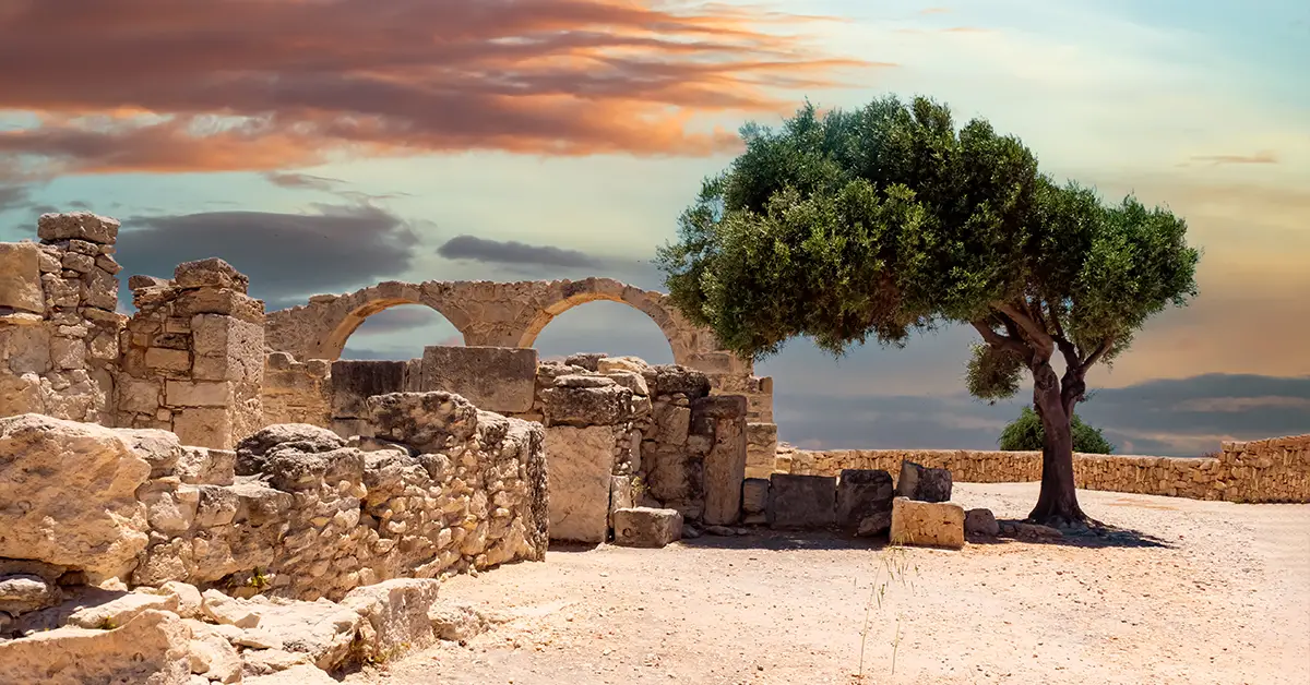
The geography of Cyprus is shaped by the special position of an island at the crossroads of Europe, Asia and Africa, givingCyprusboth strategic advantages and rare natural diversity. As the third-largest and third-most populous island in the Mediterranean, after Sicily and Sardinia, it covers 9,251 km² with a coastline of about 640 km.
With two main mountain ranges, a large central plain and a typical Mediterranean climate, the geography of Cyprus underpins every aspect of the economy, culture and daily life on the island. This article analyses in detail the most important geographical features of Cyprus.
Detailed article onThe island nation of Cyprus.
Message
Geographic location of Cyprus
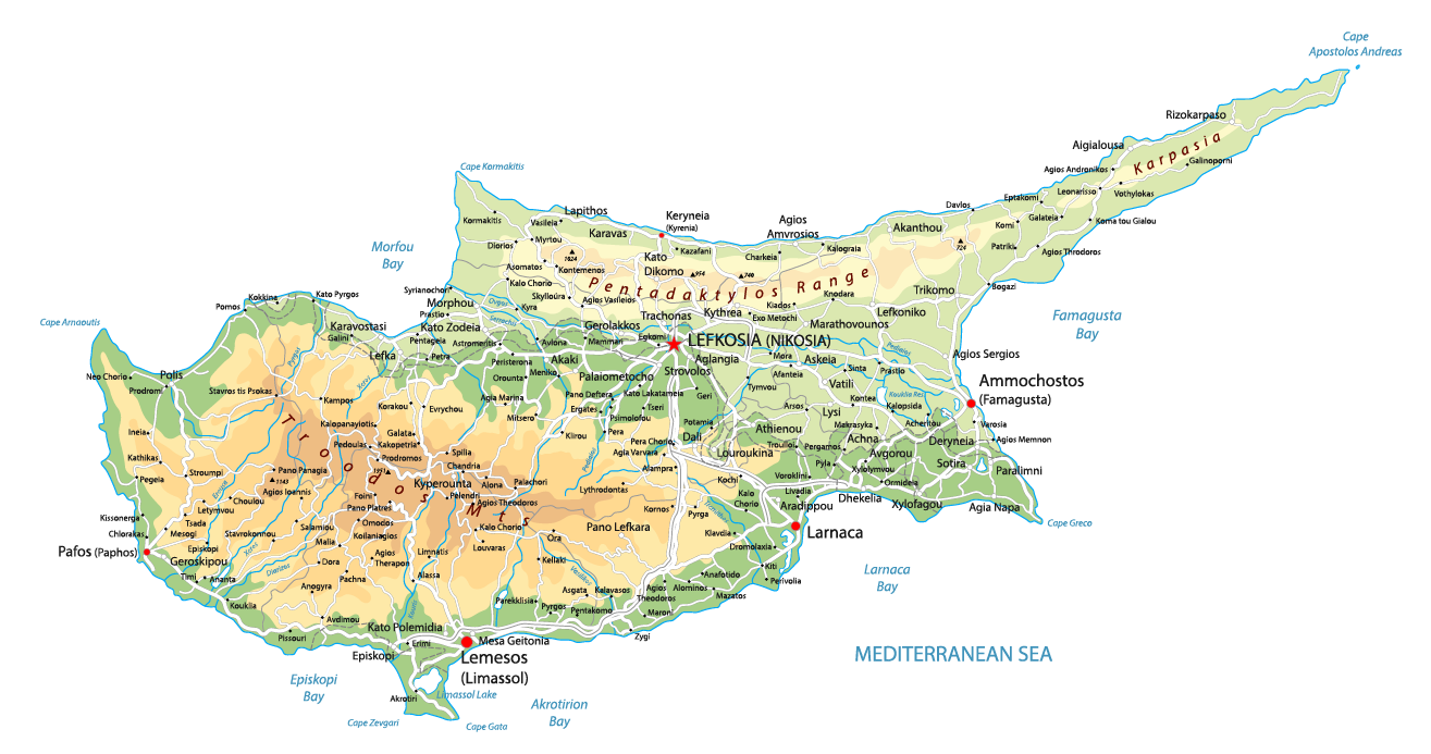
Cyprus lies in the eastern Mediterranean, in the northeastern corner of the Levantine Basin. The island is about 75 km south of the Turkish coast, 100 km west of Syria, 105 km northwest of Lebanon, 200 km north of Israel and 380 km north of the Egyptian coast. The distance to the Greek island of Rhodes is 380 km to the east.
The geographic coordinates of Cyprus range from latitude 34°33′ N to 35°41′ N and longitude 32°16′ E to 34°36′ E. Geologically, the island belongs to Asia and sits on the Cyprus Arc, part of the Anatolian geological system. However, geopolitically and culturally, Cyprus is classed as part of Europe and has been a member of the European Union since 2004.
The island has a distinctive shape, with a long, narrow peninsula in the northeast called the Karpas Peninsula, extending towards Turkey and Syria. Cyprus is up to about 240 km long along its northeast-southwest axis and up to about 100 km wide along its north-south axis. Many people compare the island’s overall shape to a frying pan with its handle pointing northeast.
Its crossroads location has shaped the history and culture of Cyprus for thousands of years. It is a natural bridge between Europe and the Middle East and an important stopover on Mediterranean shipping routes. In modern times, this location has made Cyprus a regional business and logistics hub, with shipping companies, multinationals and international financial institutions choosing the island as their base.
Find more information from the Cyprus Department of Meteorology athere.
Considering a residency programme? The Prosperous Living Investment team assesses your profile free of charge and advises on the pathway that fits your goals.
Terrain of Cyprus
The terrain of Cyprus is dominated by two main mountain ranges running almost parallel from east to west, separated by the Mesaoria plain in between. This structure creates three distinct terrain zones, each with different soils, climate and ecology.
The Troodos range is the largest mountain system, covering about a third of the island and most of the centre and southwest. The highest peak in Cyprus, Mount Olympus, at 1,952 m, is in this range. Troodos is an ancient volcanic massif formed on the floor of the Mediterranean through tectonic processes, exposing a complete ophiolite sequence that is rare in the world. Geologist Ian Graham Gass’s observations at Troodos in the 1960s made an important contribution to the theory of seafloor spreading in plate tectonics.
The Kyrenia range, also known as Pentadaktylos (Five Fingers) because of its distinctive peaks, stretches more than 100 km along the north coast. It is much lower than Troodos, with its highest peak only about 1,024 m. Kyrenia is made up mainly of Mesozoic limestone and is a southern extension of Turkey’s Taurus Mountains. Crusader castles and fortresses from the Lusignan and Venetian periods are scattered across its peaks.
The Mesaoria plain lies between the two ranges, stretching from Famagusta Bay in the east to Morphou Bay in the west, about 100 km long and 16-32 km wide. It is the most important agricultural area of Cyprus, producing cereals, vegetables, olives and grapes. The soils are mainly mineral-rich vertisols, suitable for farming but needing irrigation due to limited rainfall.
The 648 km coastline of Cyprus varies markedly between regions. The north coast is mostly rugged cliffs with a few small coves. The south and southeast coasts have many long sandy beaches and shallow bays, especially at Larnaca, Limassol, Paphos and Ayia Napa, which are famous tourist destinations. Cape Apostolos Andreas at the northeastern tip of the Karpas Peninsula is the island’s most distant point.
Climate of Cyprus
Cyprus has a typical Mediterranean climate with two distinct seasons: hot, dry summers from June to September and mild, wet winters from November to March. The short transitional seasons in April-May and October often bring rapidly changing weather. Cyprus is known as the sunniest country in Europe, with more than 300 days of sunshine a year and an average of 11.5 hours of sunshine a day in July.
In summer, daytime temperatures on the central plain and the coast usually reach 32°C to 38°C and can exceed 40°C during heatwaves. In Nicosia, the average July temperature is about 29°C, with an average daily maximum of up to 37°C. Coastal areas are more pleasant thanks to sea breezes, ranging from 24°C to 32°C. The Troodos mountains are cool, with an average July temperature of only about 22°C.
Winters in Cyprus are relatively mild on the plains and coast, with daytime temperatures ranging from 13°C to 17°C. However, the Troodos mountains can drop below 0°C and receive heavy snowfall, allowing skiing at resorts such as Platres and Troodos Square from January to March. It is one of the few countries in the Middle East region with winter sports.
Average annual rainfall in Cyprus is about 500 mm, but it is unevenly distributed. Nicosia and the Mesaoria plain receive about 350 mm a year, while the summit of Olympus can receive up to 1,050 mm, mostly as winter snow and rain. About 60% of the rain falls from December to February. Water scarcity is a long-standing challenge, leading to heavy investment in dams, reservoirs and seawater desalination plants.
Natural resources
Cyprus has a long history of copper mining, so much so that the Latin name for the metal (cuprum) derives from the island’s name. Copper mines on the slopes of the Troodos range have been worked since the third millennium BC and were an important source of copper for the ancient Mediterranean world. Mining output has fallen sharply today, but pyrite, asbestos, gypsum, limestone, marble and salt are still extracted.
Forests cover about 19% of the island according to the Cyprus Ministry of Agriculture, concentrated mainly in Troodos and Kyrenia. Cypriot forests consist mainly of Aleppo pine, black pine, the endemic golden oak (Quercus alnifolia), juniper, cedar and cypress. The system of national parks and reserves is managed by the Cyprus Department of Forests and includes Troodos National Park, the Akamas forest area and the Karpas Peninsula.
The most notable energy resources are the offshore natural gas fields discovered in Cyprus’s exclusive economic zone since 2011. The Aphrodite, Calypso, Glaucus and Cronos fields are expected to make Cyprus a producer and exporter of natural gas in the Eastern Mediterranean. The country is also investing in renewable energy, especially solar power, with a target of 23% renewables in total consumption by 2030.
Freshwater resources are a limiting factor in the geography of Cyprus. The main rivers, such as the Pedieos, Yialias and Kouris, depend on winter rainfall and often dry up in summer. To compensate, Cyprus has built 17 large dams with a total capacity of 327 million m³ of water. In addition, five seawater desalination plants are in operation, supplying about 60% of domestic water demand.
Flora and fauna
The flora of Cyprus is among the most diverse in the Eastern Mediterranean, with about 1,900 species of higher plants, including 130 endemic species found only on the island. The Cyprus golden oak, Cypriot orchids and several species of cyclamen are iconic plants. The Akamas Peninsula in the northwest is designated a Special Area of Conservation under the EU’s Natura 2000 network.
The land fauna is notable for the Cyprus mouflon (Ovis gmelini ophion), a national symbol that survives only in protected forest areas in Troodos. Mouflon numbers once fell below 15 animals in the 1930s but have recovered to more than 3,000 thanks to a strict conservation programme. The island is also home to many birds, such as Bonelli’s eagle, the griffon vulture, the barn owl and crows.
The seas and coasts of Cyprus are important breeding grounds for two protected species of sea turtle: the green turtle (Chelonia mydas) and the loggerhead turtle (Caretta caretta). Lara Beach in the Akamas area is one of the most strictly protected nesting beaches in the Mediterranean. Coastal waters are also home to dolphins, sharks and many species of Mediterranean reef fish.
Cyprus lies on one of the most important bird migration routes between Europe and Africa. Millions of migratory birds pass over the island in spring and autumn, making the Larnaca and Akrotiri salt lakes famous destinations for nature lovers. Larnaca Salt Lake is an important resting place for flamingos, with thousands gathering there every winter.
Administrative divisions
The Republic of Cyprus is divided into 6 administrative districts, each named after its main town. Nicosia District is the largest by area and population and includes the capital Nicosia, although the northern part of the district is now controlled by Northern Cyprus. Limassol District is on the south coast and is the island’s second-largest economic centre.
Larnaca District, on the southeast coast, is home to Cyprus’s main international airport and one of its most important seaports. Famagusta District legally remains part of the Republic of Cyprus, but most of its area is under the control of Northern Cyprus, with only the southern area around the town of Paralimni still administered by the legitimate government. Paphos District is in the southwest, while Kyrenia District lies entirely within the area controlled by Northern Cyprus.
The area controlled by Northern Cyprus covers about 36% of the island. The UN buffer zone, 180 km long and between 3.3 m and 7.4 km wide, separates the two areas and is monitored by UNFICYP. The two British Sovereign Base Areas at Akrotiri and Dhekelia cover 254 km², or 2.8% of the island, a legacy of the 1960 Treaty of Establishment.
The special geography of Cyprus, combining a strategic location, varied terrain and an ideal Mediterranean climate, has shaped every aspect of the country’s development.
Accompanying you on your journey in residency investment
The Prosperous Living Investment team advises on pathways, assesses profiles and manages investments transparently for every residency, citizenship and international property objective.
Free profile assessmentWhere life gets prosperous