


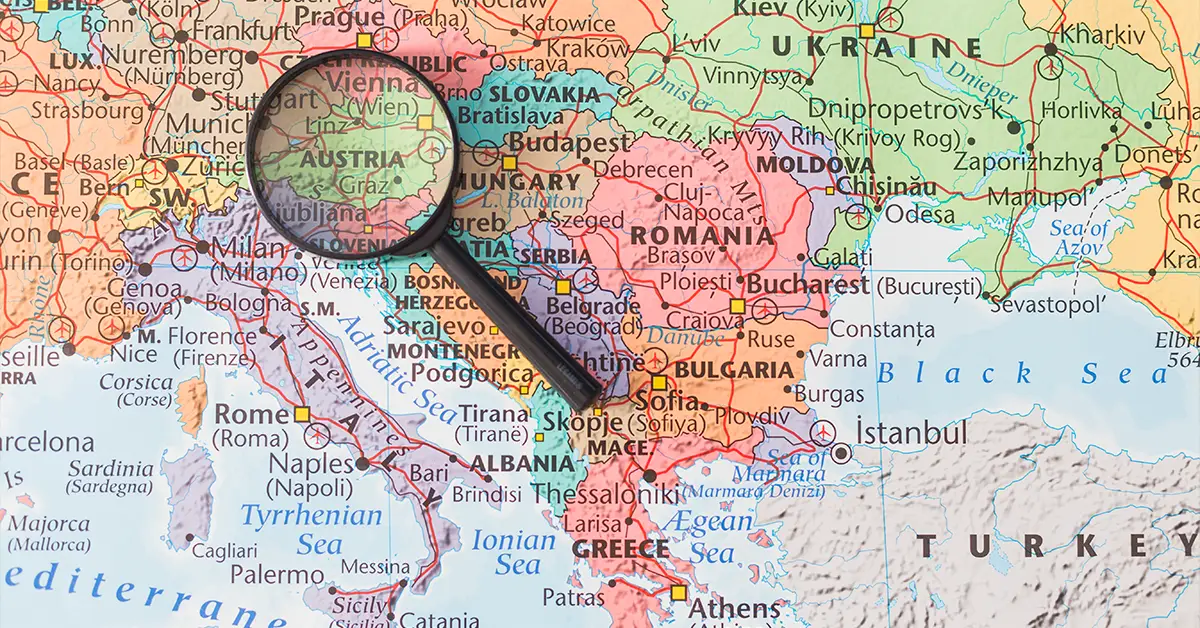
Bulgaria’s geography offers a rare diversity of terrain within a small territory — an area of 110,994 km² (roughly the size of Cuba, Iceland or the US state of Tennessee) containing peaks as high as 2,925 m, alluvial plains, limestone plateaus, the mighty Danube and 378 km of Black Sea coastline. With its strategic location in Southeastern Europe, Bulgaria is a gateway connecting Europe with the Middle East and Asia.
For foreigners considering settling inBulgaria, understanding the country’s geography is important for choosing a region to settle in that suits your lifestyle. This article analyses in detail its location, borders, three main terrain regions (the Danubian Plain, the Stara Planina and the Thracian-Rhodope Highlands), rivers, climate, national parks and the features of the Black Sea coast.
Message
Location and borders
Bulgaria lies in southeastern Europe, on the Balkan Peninsula. Its geographic coordinates are 41°15′ to 44°15′ north latitude and 22°30′ to 28°30′ east longitude. Its total border length is 2,245 km, of which 1,181 km are land borders, 686 km river borders and 378 km coastline. The river border is formed mainly by the Danube — one of the most effective river borders in Europe.
Bulgaria borders five countries. To the north lies Romania (609 km, of which 470 km follows the Danube from the mouth of the Timok to the city of Silistra). To the east lies the Black Sea (378 km of coastline). To the south lie Greece (491 km) and Turkey (240 km). To the west lie North Macedonia (162 km) and Serbia (318 km). Bulgaria’s geographic position near the Turkish Straits gives it control of strategic land routes from Europe to the Middle East and Asia.
According to CIA World Factbook, the total area is 110,879 km², with a complex border line shaped by varied terrain. The territory stretches about 420 km from west to east and 240 km from north to south. Bulgaria’s geographic centre is at Uzana — a small village in the central Stara Planina mountains, about 250 km east of Sofia.
Considering a residency programme? The Prosperous Living Investment team assesses your profile free of charge and advises on the pathway that fits your goals.
The three main terrain regions
Bulgaria’s geography is divided into three large terrain regions along a north–south axis, separated by parallel mountain ranges. The first is the Danubian Plain in the north — stretching from the Serbian border in the west to the Black Sea in the east, and separated from the rest of the country by the Stara Planina range to the south.
The Danubian Plain covers about 31,000 km², almost 28% of Bulgaria’s territory. It is the most important agricultural region, with nutrient-rich alluvial soils — mainly loess in the north, up to 100 m deep near the Danube, and chernozem (black earth) in the south. The area produces most of Bulgaria’s wheat, maize, sunflowers and tobacco. The Dobrudzha region in the north-eastern corner is especially dry (only 450 mm of rain a year) — in contrast to eastern Bulgaria.
The second region is the Stara Planina (Balkan Mountains) — Bulgaria’s longest mountain range, running 700 km from the Serbian border in the west to Cape Emine on the Black Sea in the east. An extension of the Carpathians, it acts as a natural barrier blocking cold air from the north and warm Mediterranean air from the south — a decisive factor for the climate of Bulgaria’s geography. Its highest peak is Botev (2,376 m).
The third region is the Upper Thracian Plain and the Rhodope Mountains south of the Stara Planina. The Thracian Plain along the Maritsa valley is the second most productive agricultural region, especially for vegetables, fruit, grapes and tobacco. The Rhodope, Rila and Pirin ranges contain Bulgaria’s highest peaks — Musala (2,925 m) in the Rila range is the highest peak of the Balkan Peninsula.
Mountains and peaks
Mountains are a defining feature of Bulgaria’s geography — about 23% of the territory is mountainous terrain above 600 m. Geographers identify 37 mountain ranges in Bulgaria, 36 of them south of the Stara Planina. The main ranges of Bulgaria’s geography are the Stara Planina, Sredna Gora, Rila, Pirin and Rhodope.
The Rila range is the highest, with Musala peak at 2,925 m — the highest peak of the Balkan Peninsula and of Eastern Europe (after the Caucasus). The range contains the Seven Rila Lakes — a series of glacial lakes at 2,100–2,500 m, an important spiritual and eco-tourism destination. The Rila Monastery — a UNESCO heritage site — lies at the foot of the range.
The Pirin range in the southwest contains Vihren peak at 2,914 m — the second highest in Bulgaria. Pirin National Park is a UNESCO natural heritage site with about 280 glacial lakes at 2,200–2,400 m. Lake Popovo (also called the “Pirin Sea”) is the largest of them, covering 12.4 hectares.
The Rhodope range in the south — shared with Greece — is the largest by area, stretching 220 km from east to west. Its highest peak is Golyam Perelik at 2,191 m. The Rhodopes are famous for pristine mountain forests, traditional villages and the legend of Orpheus — the mythical Greek musician said to have been born here. More than 2,000 caves are scattered across the Rhodope and Stara Planina ranges, including Bacho Kiro, Magura and Snezhanka.
Rivers
The river system of Bulgaria’s geography is quite complex, with a dense network, but most rivers are short with low flow — except the Danube. According toICPDR, the Danube basin covers 42.5% of Bulgaria’s territory, with a total area of 46,930 km² — the largest river basin in Bulgaria.
The Danube is the longest river flowing through Bulgaria — a total of 470 km forming the border with Romania. It is Europe’s second longest river (2,850 km in total), deep and wide enough for seagoing vessels along the entire Bulgarian section. Important river ports in Bulgaria’s geography: Vidin (near the Serbian border), Lom, Ruse and Silistra. The Danube is an important transport and trade route connecting Bulgaria with Germany, Austria and Hungary.
The Iskar is the longest river entirely within Bulgaria (368 km). It rises in the Rila range, flows through Sofia and cuts straight through the Stara Planina, forming the Iskar Gorge — one of Bulgaria’s most impressive natural landscapes. The Sofia — Mezdra — Vidin railway runs through this gorge, connecting the capital with northern Bulgaria and the Danube.
South of the Stara Planina, the main rivers flow to the Aegean Sea through Greece: the Maritsa (480 km, the most important river of the Balkan Peninsula), the Struma, the Mesta and the Arda. These rivers are not navigable but are important for irrigation and hydropower. The Maritsa, together with its tributaries the Tundzha and Arda, drains most of the Thracian Plain. The Kamchiya in the northeast is the only major river flowing directly into the Black Sea.
Climate
Climate is the most important aspect of Bulgaria’s geography. The country lies in a transition zone between temperate continental and Mediterranean climates, creating considerable climatic diversity within a small area. Most of the territory has a humid continental climate, with an Alpine climate on the high peaks and a subtropical climate in the far south.
Average annual rainfall in Bulgaria is 670 mm — unevenly distributed across the terrain. The Dobrudzha region in the northeast is the driest (450 mm a year), while the Ogosta river valley in the western Stara Planina is the wettest (2,293 mm a year). Mountain areas receive 1,000–1,400 mm a year. The wettest months are May (spring) and October–November (autumn).
The average annual temperature is 10.6°C, ranging from 2.2°C on Musala peak to 14.7°C in Sandanski (the southern Struma valley), according to 1991–2021 climate data. Specifically: the Danubian Plain 11.4°C, the Thracian Plain 13.9°C, low mountains 8.1°C, high mountains 2.4°C. A significant climatic contrast in Bulgaria’s geography comes from the Stara Planina barrier — the north is about 1°C colder and receives 192 mm more rain than the south.
Winter lasts from November to March — cold, with snow in Sofia 40–60 days a year and average temperatures of 0 to -5°C. Summer is warm from June to September, with average temperatures of 25–30°C and lower humidity than the Mediterranean. Spring and autumn are short but beautiful — the best seasons for visiting cities and mountain areas.
The Black Sea coast
Bulgaria’s coastline is 378 km long, stretching from Cape Sivriburun near the Romanian border in the north to the mouth of the Rezovska river at the Turkish border in the south. It is one of the standout features of Bulgaria’s geography and an important source of tourism revenue. The ancient Greeks called the Black Sea the “Hospitable Sea”.
Features of the Black Sea in Bulgaria: its water is only half as salty as the Mediterranean, there are no significant tides and no dangerous marine life. The beaches have fine sand and gentle slopes — ideal for swimming. The tourist season runs from mid-May to late September, with sea temperatures of 18–25°C in summer.
The main resorts reflect the diversity of Bulgaria’s coastal geography: Sunny Beach (Slanchev Bryag) — the largest resort, with more than 800 hotels; Albena — an upscale resort; Sozopol — an ancient Greek town; Nessebar — a UNESCO heritage town with Byzantine architecture; Sveti Vlas — a newly developed resort. The two largest coastal cities are Varna (the “sea capital”) and Burgas (an industrial port city).
The ports of Varna and Burgas are Bulgaria’s two most important seaports, connecting with the entire Black Sea region, the Caucasus, the Middle East and the Mediterranean. The port of Varna specialises in grain and machinery exports; the port of Burgas mainly serves the oil and gas industry (the Lukoil Burgas refinery — the largest on the Balkan Peninsula).
Land use and forests
Land use in Bulgaria reflects the diversity of its geography. According to 2006 data: 5% intensive artificial use, 52% agriculture including pasture, 31% forest, 11% shrubland and grassland, 1% water. Forest cover has risen steadily over the past 20 years — reaching about 38% of the territory by 2024.
Bulgaria’s forests are mainly broadleaf (75%) — chiefly oak, beech, red oak and walnut. High mountain areas have coniferous forests — pine, spruce and the Macedonian pine (Pinus peuce) unique to the region. Old-growth forests are protected in the national parks of Bulgaria’s geography: Rila (810 km²), Pirin (UNESCO heritage, 403 km²) and Central Balkan (716 km²).
Bulgaria has 11 nature reserves: Belasitsa, Balgarka, Vratsa Balkan, Golden Sands, Persina, Rila Monastery, Rusenski Lom, Sinite Kamani, Strandzha, Shumen Plateau and several others. In 2013, the first transboundary wetlands were recognised under the Ramsar Convention — including Silver-Iezerul Calarasi and the Belene Islands Complex shared with Romania.
The biodiversity of Bulgaria’s geography rates highly by EU standards — the country has 6 terrestrial ecoregions of the Palearctic realm. About 30% of the territory belongs to the EU Natura 2000 network. Endemic species include the Orpheus flower (Haberlea rhodopensis) in the Rhodopes, the Bulgarian lily, the Balkan brown bear and the lynx.
Natural resources
Bulgaria has diverse natural resources — important for the mining industry and directly linked to Bulgaria’s geography. Metal ores include copper (the Elatsite and Asarel-Medet mines are among the EU’s top producers), zinc, lead and gold (the Chelopech mine). Bulgarian bismuth is one of Europe’s major sources of supply for the electronics industry.
Energy resources include lignite in the Maritsa Iztok and Pernik areas — supplying about 40% of the country’s electricity before the green transition. Offshore oil and gas reserves in the Black Sea are modest and are being explored by Total and OMV. Bulgaria imports 95% of its crude oil and 70% of its natural gas — mainly from Russia before 2022, now diversified through Azerbaijan and imported LNG.
Bulgaria’s alluvial and black-earth farmland is among the best-quality in the EU — especially in Dobrudzha, the Thracian Plain and the Maritsa valley. This helps make Bulgaria one of the EU’s important exporters of wheat, maize and sunflower oil. Hot mineral springs — more than 600 of them — are found throughout the territory and underpin spa tourism in Sandanski, Velingrad and Hisarya.
For Vietnamese investors consideringBulgaria residency by investment, the geographic diversity opens up many real estate investment opportunities — from city apartments in Sofia, villas on the Black Sea coast and holiday homes in the Bansko ski resorts to farms on the Thracian Plain. Each geographic region of Bulgaria has its own advantages and price levels.
Summary
Bulgaria’s geography is a rare combination of varied terrain, strategic location and natural resources within a relatively small territory. The combination of the Danubian Plain in the north, the central Stara Planina, the Thracian Plain and the high Rila-Pirin-Rhodope ranges in the south, plus 378 km of Black Sea coast, creates a diverse environment suited to many different lifestyles and investments.
For foreigners considering settling or investing, understanding Bulgaria’s geography is key to choosing the right region. Sofia suits HNWIs and entrepreneurs; Plovdiv suits lovers of culture and the arts; Varna and Burgas suit those who love the sea; Bansko and Borovets suit winter sports enthusiasts; Veliko Tarnovo and small towns suit retirees seeking peace and quiet. Every geographic region of Bulgaria has its own appeal for foreigners.
Accompanying you on your journey in residency investment
The Prosperous Living Investment team advises on pathways, assesses profiles and manages investments transparently for every residency, citizenship and international property objective.
Free profile assessmentWhere life gets prosperous