


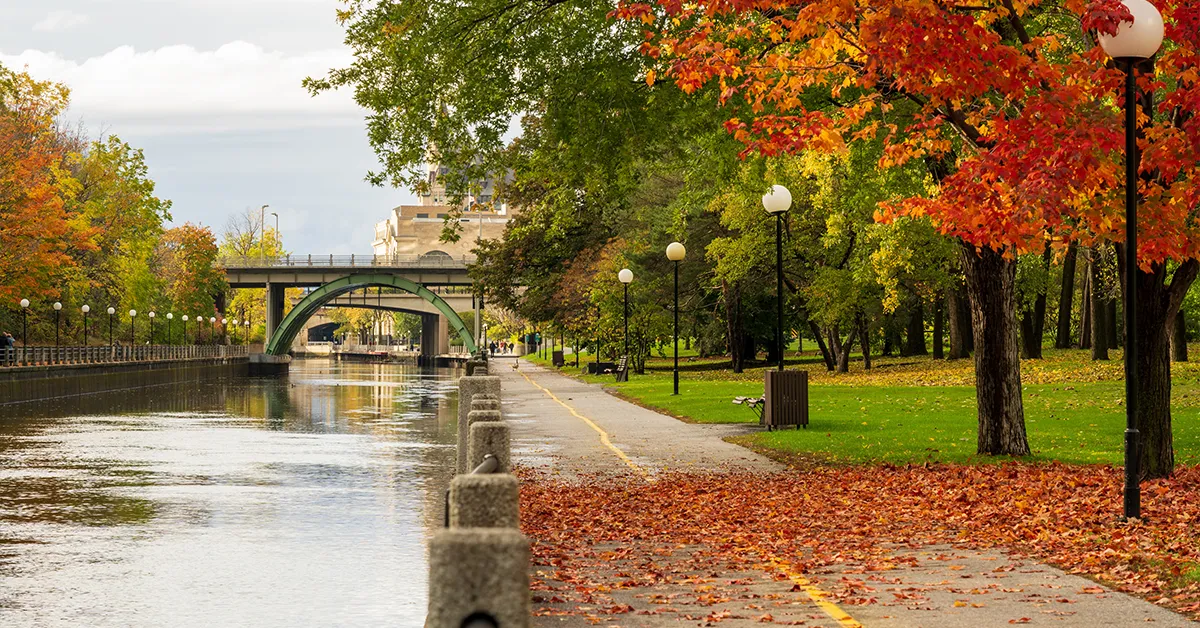
Ottawa’s geography has played a decisive role in the formation, development and standing of Canada’s capital over more than a century and a half. The city is located in the south-east of the province ofOntario, on the south bank of the Ottawa River, right at the confluence of three major rivers. This strategic position led to Ottawa being chosen as Canada’s capital in 1857, and it remains one of the country’s largest cities by area.
This article sets out in detail Ottawa’s physical and administrative geography, including its position, coordinates, boundaries, terrain, river system, climate and characteristic environmental features. This is foundational information for anyone interested in living, investing or settling in Canada’s capital.
Message
Geographical position and coordinates
Ottawa lies at the eastern extremity of the province of Ontario, in south-eastern Canada. The city’s central coordinates are around 45°25′ North and 75°42′ West, some 400 km north-east of Toronto and around 170 km west of Montreal.
According to Encyclopædia Britannica, Ottawa is located on the south bank of the Ottawa River, opposite the city of Gatineau in the province of Quebec, right at the confluence of three rivers: the Ottawa (Outaouais), the Gatineau and the Rideau. This confluence not only creates the characteristic landscape but was also the decisive factor in the site being chosen to build the Rideau Canal in the 19th century.
Ottawa’s position has an important political and cultural feature: the city lies right on the boundary between English-speaking Ontario and French-speaking Quebec. As a result, Ottawa has become one of Canada’s most notable bilingual cities and the centre of the National Capital Region (NCR).
Considering a residency programme? The Prosperous Living Investment team assesses your profile free of charge and advises on the pathway that fits your goals.
Boundaries and area
The City of Ottawa has an area of 2,790 km², making it one of the largest cities in Canada by area. To put that in perspective, Ottawa’s area is larger than the whole Greater Toronto Area, although its population is a fraction of the size.
Ottawa’s current boundaries were formed in 2001, when the old city merged with 10 other municipalities of the Regional Municipality of Ottawa–Carleton. The result was that Ottawa became a single-tier city, covering both the central urban area and the many surrounding rural, forest and agricultural areas.
The city’s main boundaries are:
- To the north:The Ottawa River forms the entire border between Ottawa and the province of Quebec. This border runs from Arnprior in the west to Rockland in the east.
- To the south:The boundary with the rural municipalities of Eastern Ontario.
- To the east:Bordering Prescott and Russell United Counties.
- To the west:Bordering Lanark County and Renfrew County.
On population, at the 2021 census Ottawa had 1,017,449 inhabitants. The Ottawa–Gatineau metropolitan area, including Gatineau on the Quebec side, has a total population of around 1,488,307, ranking fourth in Canada.
Terrain and geology
Ottawa’s terrain is where the river sediment plain meets the southern edge of the Canadian Shield – one of the world’s oldest rock formations. This gives rise to a diverse landscape of limestone cliffs, low hills, river valleys and wetlands.
The Canadian Shield geology
The Canadian Shield reaches the northern and north-western edge of the city, and is particularly evident in the Gatineau Park area across the river. The exposed pink granite there dates from the Precambrian, estimated at more than a billion years old, among the oldest rocks still observable on the Earth’s surface.
By contrast, the city centre area sits on younger sedimentary limestone and shale, formed during the period when the Champlain Sea covered this region in the last ice age. The contrast between the two geologies creates a distinctive feature: the limestone cliffs at Parliament Hill rise from the river bed, while only a few kilometres to the north the ancient granite of the Shield is reached.
Elevation and the urban landscape
Ottawa’s average elevation ranges from around 70 to 100 metres above sea level in the central area, with higher points to the south and west. The highest point within the city is Carp Ridge in the west, reaching around 190 metres.
The Ottawa Valley – where the city lies – became habitable around 10,000 years ago, after the Champlain Sea naturally receded. The Champlain Sea marine clay sediments left behind are still present in Ottawa’s subsoil, and are the cause of some subsidence at buildings constructed on weak ground.
The river system
The river system is the most prominent feature of Ottawa’s geography. Three main rivers converge in the central area of the city, creating a complex hydrological network and a distinctive landscape.
The Ottawa River
The Ottawa River (French: Rivière des Outaouais; Algonquin: Kitchissippi – meaning “Great River”) is the main tributary of the St. Lawrence River. At around 1,270 km long, the Ottawa River has a basin of more than 148,000 km², stretching across both Ontario and Quebec.
According to Encyclopædia Britannica, the Ottawa River and its main tributaries – including the Rouge, Lièvre, Gatineau, Coulonge, Rideau, Mississippi and Madawaska rivers – drain a vast area, and served as the artery of transport and trade for centuries. In the past, this river was the main route for carrying furs, timber and minerals from inland Canada to the sea ports.
Today, the Ottawa River still serves as the natural border between Ontario and Quebec, and is the landscape focal point of the whole National Capital Region.
The Rideau River and the Rideau Canal
The Rideau River flows from the south, running around 150 km, and joins the Ottawa River right in the city centre over the famous Rideau Falls. The name “Rideau” in French means “curtain”, reflecting the shape of the falls as the water drops.
The Rideau Canal, built from 1826 to 1832 under the direction of Colonel John By, links the Rideau River with Lake Ontario at Kingston. It was the engineering work that entirely changed the face of Ottawa and the reason the city was founded. The Rideau Canal was designated a UNESCO World Heritage Site in 2007, and still operates today as a tourist and recreational waterway.
The Gatineau River
The Gatineau River runs around 390 km, flowing from the north in the province of Quebec down to its confluence with the Ottawa River, forming the eastern boundary of the city of Gatineau. This river was an important timber transport route from the 19th century until 1991.
Climate
Ottawa’s climate is classified under the Köppen system as Dfb – a humid continental climate with warm summers and no dry season. This gives four distinct seasons, in which the temperature difference between winter and summer may exceed 60°C.
Winter
Winter in Ottawa is long and cold, usually from November to early April. The average January temperature – the coldest month – ranges from -14.5°C to -6.3°C. On the coldest days, temperatures may fall below -25°C.
The record low temperature recorded in Ottawa is -37.2°C in January 1957. According to Wikipedia, extreme lows below -30°C occur on average about once every two years.
Average annual snowfall is around 175 cm to 232 cm, depending on the data source and observation period. Snow usually covers the ground from November to April, making Ottawa one of the snowiest capitals in the world. The Rideau Canal freezes completely in winter and becomes the world’s longest naturally frozen skating rink – the Rideau Canal Skateway.
Summer
Summer in Ottawa is hot and humid, running from late June to September. The average July temperature – the hottest month – ranges from 14.5°C (at night) to 25.3°C (during the day). The average July maximum reaches around 27°C, and heatwaves may push temperatures above 30°C on around 15 days a year.
The record high temperature recorded in Ottawa is 37.3°C in August 2001. Summer humidity is usually high, particularly as the city lies in a valley where humid air is easily trapped. Thunderstorms occur on average on 23 days a year, mainly in July and August.
Spring and autumn
Spring in Ottawa is usually short, running from late March to May. The weather in this period may be highly changeable because of the collision between cold air masses from the north and warm air from the south. By May, average daytime temperatures reach around 19°C, and the city welcomes the Canadian Tulip Festival at Commissioners Park – one of the largest tulip festivals in the world.
Autumn runs from September to November, with cool weather and vivid scenery as the leaves turn their characteristic red, orange and yellow. Many visitors consider this the most beautiful time of year in Ottawa.
Rainfall
Total average annual precipitation in Ottawa is around 1,068 mm, distributed fairly evenly through the year. June has the highest rainfall at around 102 mm, while February is the driest month at around 63 mm. Alongside rain, snow accounts for a significant share of precipitation in the winter months.
Green space and ecosystems
One of Ottawa’s most notable geographical features is its very high proportion of green space. An estimated half the city’s area is green space – including parks, forest, wetland and farmland. It is because of this that Ottawa is often called “the greenest capital in the world”.
The Greenbelt
The Greenbelt is a protected band of rural and forest land surrounding central urban Ottawa, covering around 200 km². Established in 1950 on the proposal of the planning architect Jacques Gréber, the Greenbelt is one of the largest and longest-protected green belts of any capital in the world.
Theo the National Capital Commission of Canada (NCC), the Greenbelt now provides habitat for hundreds of plant and animal species, including several wetland areas of international conservation value.
Gatineau Park
Gatineau Park, across the Ottawa River in the province of Quebec, covers around 361 km². It is one of the largest urban parks in the world, famous for the Gatineau Hills – the southern end of the Laurentians. This park offers hiking, cycling, skiing and four-season outdoor activities for Ottawa residents.
Rivers, lakes and wetlands
Beyond the three main rivers, Ottawa also has many small lakes and important wetlands. The Mer Bleue Conservation Area is a well-known peat bog, recognised as a wetland of international importance under the Ramsar Convention. This area is a stopping point for many migratory birds and home to rare subarctic plant species.
Seismic risk and natural disasters
Although Canada is not known as a country of strong seismic activity, the Ottawa–Gatineau region lies on a number of significant faults. Small earthquakes of intensity III or above occur on average at least once every three years in the region.
The most memorable earthquake was the Central Canada Earthquake of 2010, with its epicentre around 56 km north of Ottawa, in the Val-des-Bois area of Quebec. This earthquake caused strong shaking but no serious loss of life or property.
Alongside earthquakes, Ottawa sometimes faces severe winter blizzards, spring flooding from snowmelt and strong summer thunderstorms. The city authorities have built warning and response systems appropriate to each type of natural disaster.
Geographical standing and the role of capital
Ottawa’s geographical position is no accident. When Queen Victoria chose it as the capital of the Province of Canada in 1857, the city had several clear strategic advantages: it lay far enough from the United States border to reduce military risk, it had a major waterway connecting to the St. Lawrence, and it sat between the English-speaking and French-speaking regions – balancing the interests of Canada’s two major language communities.
Today, Ottawa is the centre of the National Capital Region (NCR) – Canada’s only interprovincial region, comprising Ottawa in Ontario and Gatineau in Quebec.The National Capital Commissionis the federal body managing a significant share of the land in the region, including many important historic and tourist sites in both cities.
For Vietnamese readers interested inCanadian citizenshipor consideringsettling in Canada, Ottawa is a notable choice thanks to its high quality of life, low crime rate, bilingual environment and green space far exceeding that of other major world capitals.
Conclusion
Ottawa’s geography is a distinctive combination of the billion-year-old ancient rock of the Canadian Shield, three major rivers converging in the centre, the vast valley carved by the Champlain Sea, and a continental climate with four distinct seasons. The city covers 2,790 km² – larger than many of Canada’s major cities – with nearly half of it long-protected green space.
It is these geographical features that have shaped not only the history, architecture and cultural life of Canada’s capital, but also created a unique living environment for more than a million residents in the region. Understanding Ottawa’s geography is the foundation for grasping the city’s other aspects – from the economy and population through to investment and settlement opportunities.
To find out more about the city and related opportunities in Canada, readers may consult the overview article onOttawaor the in-depth articles on the province ofOntarioand Canadian settlement programmes on the PLI website.
Accompanying you on your journey in residency investment
The Prosperous Living Investment team advises on pathways, assesses profiles and manages investments transparently for every residency, citizenship and international property objective.
Free profile assessmentWhere life gets prosperous