


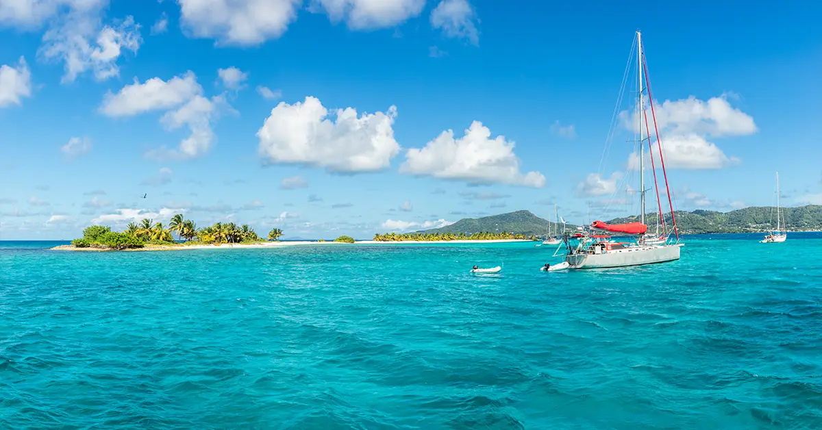
Grenada’s geography is a story of volcanoes, tropical seas and diverse ecology. Lying at the southern end of the Lesser Antilles in the eastern Caribbean Sea, Grenada is a three-island nation comprising Grenada, Carriacou and Petite Martinique, together with around 600 uninhabited islets and reefs. The country’s strategic position — around 160 km north of Venezuela — has shaped its entire climate, vegetation and people’s livelihoods over the centuries.
For those looking intoGrenadaas a destination forcitizenship by investment, understanding the country’s basic geography is the first step in assessing property potential, tourism opportunities and natural disaster risk. This article brings together the key geographical factors, from coordinates and area through to climate, terrain and the island nation’s distinctive ecological features.
Message
Position and geographical coordinates
Grenada lies at latitude 12°07′ North and longitude 61°40′ West, at the southern end of the Windward Islands chain in the Lesser Antilles arc. This island nation is around 160 km north of the Venezuelan coast, around 145 km north of Trinidad and Tobago, and around 145 km south-west of Barbados.
Its nearest neighbours by sea are Saint Vincent and the Grenadines to the north, and Trinidad and Tobago to the south. The maritime boundaries with these countries are delimited by Caribbean maritime agreements and the United Nations Convention on the Law of the Sea (UNCLOS).
This position gives Grenada a strategic role in Caribbean maritime trade. The Martinique Channel separates Grenada from Saint Vincent and the Grenadines, and also marks the boundary between the two parts of the Grenadines: the southern part belonging to Grenada (Carriacou, Petite Martinique and the islets), and the northern part to Saint Vincent and the Grenadines.
Considering a residency programme? The Prosperous Living Investment team assesses your profile free of charge and advises on the pathway that fits your goals.
Area and the three-island structure
Theo the Embassy of Grenada in the United States, Grenada’s total land area is around 348.5 km² (134.6 square miles), making it one of the smallest independent countries in the Caribbean.
The main island of Grenada is the largest at around 310 km², oval in shape, up to 34 km long from north to south and up to 19 km wide from east to west. The capital Saint George’s lies on the south-west coast of the main island, with one of the finest natural harbours in the Caribbean. The island is divided into 6 administrative parishes: Saint George, Saint John, Saint Mark, Saint Patrick, Saint Andrew and Saint David.
Carriacou is the second largest island, at around 34 km² (13 square miles), with a population of around 9,595 at the 2019 census. The island stretches around 11 km from Pegus Point in the south to Gun Point in the north. The main settlement is Hillsborough — Carriacou’s principal town.
Petite Martinique is the smallest inhabited island, at only 2.37 km² (586 acres), with a population of around 900. The island lies around 4 km north-east of Carriacou. Its highest point is Piton at 228 m (750 feet). Petite Martinique has no airport, is reached mainly by sea, and is known for its traditional boatbuilding.
Carriacou and Petite Martinique are administered together as a single parish called Carriacou and Petite Martinique, which has had dependency status within Grenada since 1974.
Volcanic origins and terrain
Grenada is of volcanic origin, part of the Lesser Antilles volcanic arc — where the Caribbean plate interacts with the North Atlantic plate. Ancient volcanic activity created its characteristic terrain: a hilly central core, a rugged coastline with many small bays, and fertile soil suited to tropical agriculture.
Grenada’s terrain is mainly hilly. According to the Second National Communication report submitted by the Government of Grenada to theUnited Nations Framework Convention on Climate Change (UNFCCC), around 71% of the main island’s land area has a slope of more than 20 degrees. Carriacou is less rugged with around 50% of its land above 20 degrees, while Petite Martinique has the steepest terrain with 90% of its land exceeding 20 degrees.
Grenada’s highest point is Mount Saint Catherine at 840 m (2,757 feet) in the northern part of the main island. This mountain is the summit of an extinct volcano, largely covered in primary rainforest. Other high peaks include Fédon’s Camp, Mount Qua Qua and Mount Maitland, forming a mountainous spine running north–south along the island.
The island also has many traces of volcanic activity: ancient craters now forming lakes such as Grand Etang Lake in the centre of the island, Lake Antoine in the north, and Levera Pond on the northern coast. Off the northern coast of Grenada, Kick ’em Jenny is an active submarine volcano, lying around 180 m below the surface. This volcano has erupted at least 14 times since 1939 and is continuously monitored by the Seismic Research Centre of the University of the West Indies.
The coastline of the main island of Grenada runs around 121 km, with many small bays, peninsulas and white sand beaches. The most notable is Grand Anse, around 3 km long in the south-west — regularly ranked among the finest beaches in the Caribbean.
The tropical climate and two distinct seasons in Grenada’s geography
Grenada has a tropical marine climate, with stable temperatures year round, from 24°C to 30°C. The average annual temperature is around 27°C. The sea around the island has water temperatures of 26°C to 30°C, creating ideal conditions for marine tourism and water activities year round.
The climate divides into two distinct seasons:
- The dry season: from January to May, with little rain, sunshine and strong north-easterly trade winds. This is the peak tourist season.
- The wet season: from June to December, with abundant rainfall, particularly concentrated in July, August and September. This season also coincides with the Atlantic hurricane season.
Rainfall varies greatly with the terrain. On the coastal lowlands, average annual rainfall ranges from 1,000 to 1,500 mm. In the central mountains, because of the orographic effect, rainfall may reach 4,000 mm a year, creating the conditions for primary tropical rainforest.
Carriacou and Petite Martinique have a considerably drier climate than the main island. Because of their small size and lower terrain, these two islands have no orographic effect, with lower rainfall (under 1,000 mm a year), much arid land and drought-resistant scrub.
Hydrology and water resources
The main island of Grenada has a diverse hydrological network. The central mountains give rise to around 71 small catchments with short streams, radiating out from the centre to the sea in all directions. The important rivers are the Saint John River, the Grand Roy River, the Beausejour River and the Great River.
There are no large natural lakes, but ancient craters have formed several small ones: Grand Etang Lake at an altitude of 530 m, covering around 15 hectares, is an important water source for the centre of the island. Lake Antoine in the north is a broad, shallow crater, surrounded by the remains of a 19th-century sugar plantation.
By contrast, Carriacou and Petite Martinique have almost no permanent surface water. The people of these two islands depend on rainwater collected in cisterns and groundwater from boreholes. Seawater desalination projects are being rolled out to improve fresh water security.
Ecosystems and biodiversity
The diversity of altitude and rainfall in Grenada’s geography has created many different ecosystems on the main island. The main ecological zones are:
- Montane rainforestin the centre of the island, around Grand Etang and Mount Saint Catherine
- Lowland broadleaf foreston the lower slopes
- Dry scrub woodlandin coastal areas with dry winds
- Mangroveat river mouths and coastal marshes
- Coral reefsaround the island, particularly to the west and south
Grenada is home to several endemic species. The Grenada dove (Leptotila wellsi) is the only endemic species and a national symbol, currently listed as Critically Endangered on the IUCN Red List. The population is down to only a few dozen individuals, mainly in Mount Hartman National Park in the south-west of the island. According to the latest ornithological research, a total of around 199 bird species had been recorded in Grenada as at June 2024.
The island’s mammals include the opossum, the armadillo, and introduced species such as the mona monkey (Cercopithecus mona) — brought from Africa in colonial times — and the mongoose, introduced to control snakes on the sugar plantations. The waters around Grenada hold many tropical fish species, sea turtles, dolphins and occasionally whales.
The Molinere Underwater Sculpture Park, created in 2006 by the artist Jason deCaires Taylor, is the world’s first underwater sculpture park. The sculptures act as artificial reefs, attracting marine life and helping restore damaged coastal ecosystems.
Natural disaster risk: hurricanes and earthquakes
Grenada’s geographical position in the Caribbean Sea leaves the island nation vulnerable to tropical storms and depressions during the Atlantic hurricane season from June to November. Although it lies at the southern end of the hurricane belt, where the risk is lower than for the islands to the north, Grenada is not immune.
Hurricane Ivan in September 2004 was the greatest natural disaster in Grenada’s modern history. The category 3 hurricane made a direct landfall on the main island, causing damage estimated at 200% of GDP, destroying around 90% of homes, killing 39 people and devastating the whole agricultural sector, particularly the centuries-old nutmeg groves.
More recently, Hurricane Beryl in July 2024 swept across Carriacou and Petite Martinique at category 4. On Petite Martinique, 98-99% of homes were destroyed or seriously damaged, causing large-scale displacement. This event was a reminder of how vulnerable small islands are to climate change and the increasing intensity of hurricanes.
Beyond hurricanes, Grenada also lies in a seismically active area because of its position on a tectonic plate boundary. The submarine volcano Kick ’em Jenny is continuously monitored, although recent eruptions have not caused serious damage on land. A tsunami is a potential risk where Kick ’em Jenny erupts violently or a major earthquake occurs in the region.
Soil, agriculture and the Spice Isle nickname
Grenada’s volcanic soil is rich in minerals and highly suited to tropical agriculture. This is the foundation of the country’s famous “Spice Isle” nickname, as Grenada is the world’s second largest producer of nutmeg and mace, after only Indonesia.
The main crops are:
- Nutmeg: the emblem on Grenada’s flag
- Cinnamon (cinnamon)
- Cloves (clove)
- Cacao: the raw material for high-quality chocolate, particularly the Grenada Chocolate Company brand
- Bananas and tropical fruit: mangoes, papayas, guavas and starfruit
- Coconuts: grown mainly in coastal areas
Around 28% of the land area is used for agriculture, mostly smallholdings and family gardens. Inshore fishing also plays an important role in the livelihoods of coastal communities, particularly on Carriacou and Petite Martinique.
National parks and conservation
Grenada has a diverse system of protected areas to safeguard its natural heritage. The main national parks and reserves are:
- Grand Etang National Park: the central reserve with its crater lake, rainforest and Annandale Falls
- Mount Hartman National Park: where the endemic Grenada dove population is conserved
- Molinere Beausejour Marine Protected Area: protecting the coral reefs and the underwater sculpture park
- Levera Protected Area: northern coastal wetland, a sea turtle nesting site
- La Sagesse Bird Sanctuary: south-eastern coastal wetland
These protected areas are managed by Grenada’s Ministry of Water Resources and the Environment. Ecotourism is growing strongly, providing an economic driver while also promoting biodiversity conservation.
Conclusion — Grenada’s geography and its role in development
Grenada’s geography combines the features of a typical tropical volcanic island with its own distinctive characteristics: a compact scale, a unique three-island structure, hilly terrain with fertile volcanic soil, a pleasant maritime climate and diverse ecosystems from rainforest to coral reef. These factors form the foundation for its famous spice agriculture, a growing ecotourism industry and a strategic position in the Caribbean.
However, its geographical position also brings significant natural disaster risk — tropical storms, submarine volcanic activity and the effects of climate change — factors property investors, settlers and businesses need to consider when deciding on a long-term commitment to the island nation.
For individuals and families consideringGrenadain the context ofGrenada citizenship by investmentora second citizenship, understanding the geography is the foundation for accurately assessing the value of an investment, choosing the right area and planning for natural disaster risk. Grenada’s geography is not dry data but the living context in which every economic, social and political decision on the island is shaped each day.
Accompanying you on your journey in residency investment
The Prosperous Living Investment team advises on pathways, assesses profiles and manages investments transparently for every residency, citizenship and international property objective.
Free profile assessmentWhere life gets prosperous